|
search place name
|
||
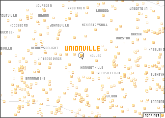
Unionville (Maryland, United States - USA)Unionville is a town in the Maryland region of United States - USA. An overview map of the region around Unionville is displayed below.
regional and 3d topo map of Unionville, United States - USA ::
Unionville airports ::
The nearest airport is BWI - Baltimore Washington Intl, located 55.6 km south east of Unionville.
Other airports nearby include IAD - Washington Dulles Intl (63.3 km south), DCA - Ronald Reagan Washington Natl (70.3 km south), ADW - Camp Springs Andrews Afb (Washington Dc Naf) (78.7 km south), APG - Aberdeen Phillips Aaf (87.5 km east), Nearby towns ::
Bessie Clemson Heights (1.8km north west) //
Oldfield (2.5km north) //
Byrons Manor (2.6km south west) //
Holler (2.5km east) //
Fox Ridge Estates (3.0km west) //
Burrier Knob (3.5km south west) //
Harvest Hills (3.5km south east) //
Oak Orchard (3.3km north east) //
Potomac Estates (4.1km south) //
Glisson Place (3.5km south west) //
Linganore Woods (3.8km south west) //
Harrisville Farmettes (4.4km south) //
Harrisville Heights (4.4km south) //
Linganore (4.3km south west) //
South Timber (4.5km south) //
Heise (4.4km south west) //
Gallagher Estates (4.8km south) //
Liberty Knolls (3.9km west) //
McDonald (5.0km south) //
Lovejoy Estates (5.1km north) //
Clemsonville (5.2km north) //
Edgewood (4.6km north east) //
Hemp Hills (4.5km north east) //
Fuller (5.3km south east) //
Resourceful Acres (5.7km south) //
Libertytown (4.8km west) //
Carsan Knolls (6.2km south) //
Crampton (6.6km south) //
Matherwood Heights (6.9km south) //
[all distances 'as the bird flies' and approximate] 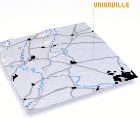 Places with similar names to Unionville, United States - USA ::
// Union Valley (US)
// Unionville (US)
// Unionville (US)
// Unionville (US)
// Unionville (US)
// Unionville (US)
// Unionville (US)
// Unionville (US)
// Unionville (US)
// Unionville (US)
Disclaimer :: Information on this page comes without warranty of any kind |
||
|
Where is Unionville? Elevation and coordinates ::
Latitude (lat): 39°28'29"N Longitude (lon): 77°11'9"W
Elevation (approx.): 137m (map arrows pan, magnifying glasses zoom) |
||
|
Visiting Unionville? Hotel/Accommodation ::
Book a hotel in Unionville Travel Guide ::
rental cars ::
car rental offers GPS waypoint ::
download a GPX waypoint (PoI) of Unionville for your GPS receiver
|
||