|
search place name
|
||
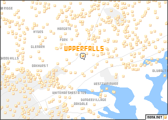
Upper Falls (Maryland, United States - USA)Upper Falls is a town in the Maryland region of United States - USA. An overview map of the region around Upper Falls is displayed below.
regional and 3d topo map of Upper Falls, United States - USA ::
Upper Falls airports ::
The nearest airport is APG - Aberdeen Phillips Aaf, located 20.5 km east of Upper Falls.
Other airports nearby include BWI - Baltimore Washington Intl (37.0 km south west), ILG - Wilmington New Castle (73.6 km east), ADW - Camp Springs Andrews Afb (Washington Dc Naf) (80.3 km south west), DCA - Ronald Reagan Washington Natl (85.0 km south west), Nearby towns ::
Walnut Hills Estates (1.5km north) //
Kingsville (1.8km north west) //
Jerusalem Mills (2.4km north) //
Franklinville (2.0km north east) //
Glenbauer (2.7km north) //
Bradshaw (2.5km south east) //
Darryl Gardens (3.0km south) //
Gunpowder (2.8km south east) //
Oaklyn Manor (2.5km east) //
Jerusalem (3.1km north east) //
Clear Acres (2.6km east) //
Kings Country (2.6km west) //
Forge Acres (3.2km south west) //
Lereley (3.5km south) //
Wesley Woods (3.7km north) //
Merrywood (3.3km north west) //
Batter Brook Farms (3.0km west) //
Valleybrook (3.8km north east) //
Forge Heights (3.6km south west) //
Shannon Heath (3.3km east) //
Lincrest (3.8km north east) //
Kenwood Farm Estates (3.5km north east) //
Correlli Estates (3.9km south west) //
Joppa Acres (3.7km east) //
Pleasant Hills (4.8km north) //
Green Springs Hills (4.0km north east) //
Richlyn Manor (4.0km south west) //
Stockton (4.6km north east) //
Mountain (4.3km north east) //
[all distances 'as the bird flies' and approximate] 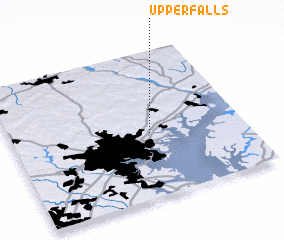 Places with similar names to Upper Falls, United States - USA ::
// Upper Falls (US)
Disclaimer :: Information on this page comes without warranty of any kind |
||
|
Where is Upper Falls? Elevation and coordinates ::
Latitude (lat): 39°26'14"N Longitude (lon): 76°24'13"W
Elevation (approx.): 76m (map arrows pan, magnifying glasses zoom) |
||
|
Visiting Upper Falls? Hotel/Accommodation ::
Book a hotel in Upper Falls Travel Guide ::
rental cars ::
car rental offers GPS waypoint ::
download a GPX waypoint (PoI) of Upper Falls for your GPS receiver
|
||