|
search place name
|
||
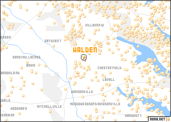
Walden (Maryland, United States - USA)Walden is a town in the Maryland region of United States - USA. An overview map of the region around Walden is displayed below.
regional and 3d topo map of Walden, United States - USA ::
Walden airports ::
The nearest airport is BWI - Baltimore Washington Intl, located 16.7 km north of Walden.
Other airports nearby include ADW - Camp Springs Andrews Afb (Washington Dc Naf) (29.1 km south west), DCA - Ronald Reagan Washington Natl (37.0 km south west), APG - Aberdeen Phillips Aaf (65.5 km north east), IAD - Washington Dulles Intl (68.4 km west), Nearby towns ::
Crofton Village (0.5km north) //
Crofton Mews (0.6km north west) //
Crofton Highlands (1.2km south east) //
Riedel Estates (1.1km south west) //
Charing Cross (1.4km south west) //
Crofton Commons (1.6km south) //
Saint Stephens Estates (1.8km north) //
Blue Ridge At Crofton Meadows (1.9km south) //
Crofton Square (2.0km south) //
Conaways (1.7km west) //
Brandy Farms (2.1km north east) //
Saddle Ridge (1.9km south west) //
Amberfield (1.8km west) //
Courts of Crofton (2.7km south) //
Crofton Village Green (2.4km south west) //
Crofton (2.9km south west) //
Crofton Park (3.0km south west) //
The Greens of Crofton (3.4km south) //
Chestnut Ridge (3.1km south east) //
Baldwin Hills South (2.9km north east) //
Crofton South (3.4km south) //
Odenton Park (3.2km north west) //
Baldwin Hills (3.3km north east) //
Stonegate Village (3.7km south) //
Tanager Forest (3.4km north east) //
Andersons Corner (3.9km north east) //
Crofton Woods (3.8km south west) //
Hermitage Hill (3.9km south east) //
Mistwood (4.1km north west) //
[all distances 'as the bird flies' and approximate] 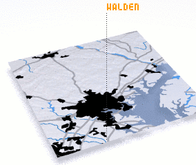 Places with similar names to Walden, United States - USA ::
Disclaimer :: Information on this page comes without warranty of any kind |
||
|
Where is Walden? Elevation and coordinates ::
Latitude (lat): 39°1'30"N Longitude (lon): 76°40'24"W
Elevation (approx.): 36m (map arrows pan, magnifying glasses zoom) |
||
|
Visiting Walden? Hotel/Accommodation ::
Book a hotel in Walden Travel Guide ::
rental cars ::
car rental offers GPS waypoint ::
download a GPX waypoint (PoI) of Walden for your GPS receiver
|
||