|
search place name
|
||
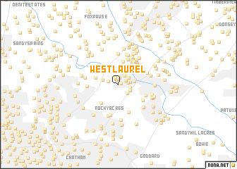
West Laurel (Maryland, United States - USA)West Laurel is a town in the Maryland region of United States - USA. An overview map of the region around West Laurel is displayed below.
regional and 3d topo map of West Laurel, United States - USA ::
West Laurel airports ::
The nearest airport is BWI - Baltimore Washington Intl, located 21.7 km north east of West Laurel.
Other airports nearby include DCA - Ronald Reagan Washington Natl (30.1 km south west), ADW - Camp Springs Andrews Afb (Washington Dc Naf) (32.4 km south), IAD - Washington Dulles Intl (51.2 km west), APG - Aberdeen Phillips Aaf (75.0 km north east), Nearby towns ::
Sandy Spring Estates (0.4km north east) //
West Laurel Acres (0.8km north) //
Bond Mill Park (1.1km north) //
Wyndham Woods (1.1km north) //
Walker Hill (1.1km north east) //
Scotchtown Hills (1.2km east) //
McCahill Estates (1.6km north east) //
New Birmingham Manor (1.4km west) //
Cherrywood (1.5km east) //
Rocky Gorge Estates (1.6km north east) //
Carriage Hill (1.5km east) //
Robeys Farmlets (1.7km south east) //
Mayfair (1.8km south east) //
Hillsborough (2.1km north) //
Stonewood (2.0km east) //
Valley Stream Estates (2.1km west) //
Coon Manor (3.7km north) //
Burtonsville (3.0km west) //
Greencastle Manor (3.6km south west) //
Chelsea Estates (4.0km north east) //
Pine Valley (4.1km north) //
Lakeview (4.0km north east) //
Tower Acres (4.1km north east) //
Lillys Addition (4.1km north east) //
Contee (3.8km south east) //
High Ridge (4.3km north east) //
Cardinal Forest (4.0km north east) //
Oak Crest (3.7km south east) //
Muirkirk (4.6km south) //
[all distances 'as the bird flies' and approximate] 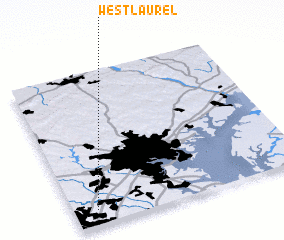 Places with similar names to West Laurel, United States - USA :: Disclaimer :: Information on this page comes without warranty of any kind |
||
|
Where is West Laurel? Elevation and coordinates ::
Latitude (lat): 39°6'4"N Longitude (lon): 76°54'0"W
Elevation (approx.): 113m (map arrows pan, magnifying glasses zoom) |
||
|
Visiting West Laurel? Hotel/Accommodation ::
Book a hotel in West Laurel Travel Guide ::
rental cars ::
car rental offers GPS waypoint ::
download a GPX waypoint (PoI) of West Laurel for your GPS receiver
|
||