|
search place name
|
||
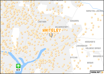
Whiteley (Maryland, United States - USA)Whiteley is a town in the Maryland region of United States - USA. An overview map of the region around Whiteley is displayed below.
regional and 3d topo map of Whiteley, United States - USA ::
Whiteley airports ::
The nearest airport is DCA - Ronald Reagan Washington Natl, located 14.2 km south west of Whiteley.
Other airports nearby include ADW - Camp Springs Andrews Afb (Washington Dc Naf) (16.0 km south), BWI - Baltimore Washington Intl (33.9 km north east), IAD - Washington Dulles Intl (45.7 km west), NHK - Patuxent River Nas (86.1 km south east), Nearby towns ::
Edmonston (0.3km west) //
Rogers Heights (0.6km east) //
Bladensburg (1.0km south west) //
Ducat Town (1.1km north east) //
Green Manor (1.4km north) //
Springbrook Terrace (1.3km north east) //
Villa Heights (1.4km south east) //
East Riverdale (1.7km north) //
Riverdale Park (1.8km north) //
Ellaville (1.9km north west) //
Hyattsville (1.8km north west) //
Riverdale Heights (2.2km north east) //
West Riverdale (2.2km north west) //
Cottage City (2.0km south west) //
Cheverly (2.4km south east) //
Colmar Manor (2.2km south west) //
East Pines (2.1km north east) //
North Brentwood (2.1km west) //
Defense Heights (2.1km east) //
Riverdale Hills (2.4km north east) //
North Kenilworth (2.8km south) //
Riverdale Gardens (2.7km north east) //
Hyattsville Hills (2.5km north west) //
Landover Park (2.8km south east) //
Highland (2.4km south west) //
University Park (2.9km north west) //
Tuxedo (3.0km south) //
Castle Manor (2.5km west) //
Calvert Hills (3.2km north) //
[all distances 'as the bird flies' and approximate] 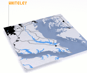 Places with similar names to Whiteley, United States - USA ::
Disclaimer :: Information on this page comes without warranty of any kind |
||
|
Where is Whiteley? Elevation and coordinates ::
Latitude (lat): 38°56'49"N Longitude (lon): 76°55'42"W
Elevation (approx.): 13m (map arrows pan, magnifying glasses zoom) |
||
|
Visiting Whiteley? Hotel/Accommodation ::
Book a hotel in Whiteley Travel Guide ::
rental cars ::
car rental offers GPS waypoint ::
download a GPX waypoint (PoI) of Whiteley for your GPS receiver
|
||