|
search place name
|
||
Cambridgeport (Massachusetts, United States - USA)Cambridgeport is a town in the Massachusetts region of United States - USA. An overview map of the region around Cambridgeport is displayed below.
regional and 3d topo map of Cambridgeport, United States - USA ::

nearby GPS traces from timatio ::
Cambridgeport airports ::
The nearest airport is BOS - Boston General Edward Lawrence Logan Intl, located 8.2 km east of Cambridgeport.
Other airports nearby include BED - Bedford Laurence G Hanscom Fld (19.6 km north west), PVD - Providence Theodore Francis Green State (74.3 km south), CEF - Chicopee Falls Westover Arb Metropolitan (119.4 km west), BDL - Windsor Locks Bradley Intl (138.6 km west), Nearby towns ::
Cambridge (1.9km north) //
Longwood Station (1.9km south) //
Back Bay (1.7km south east) //
Allston (1.8km west) //
Old Cambridge (2.4km north west) //
Coolidge Corner (2.2km south west) //
East Cambridge (2.2km north east) //
Brookline Village (3.0km south) //
Somerville (3.3km north) //
Roxbury Crossing (3.3km south) //
Spring Hill (3.4km north) //
Brookline (3.3km south west) //
East Somerville (3.4km north east) //
Roxbury (3.8km south) //
North Brighton (2.9km west) //
Bay Village (2.9km east) //
Beacon Hill (2.9km east) //
Winter Hill (4.2km north) //
Coolidge Hill (3.4km north west) //
Ten Hills (4.5km north) //
West Somerville (4.4km north) //
Beaconsfield (3.9km south west) //
Boston (3.6km east) //
North Cambridge (4.7km north west) //
Charlestown (4.0km north east) //
Downtown Crossing (3.8km east) //
Dock Square (3.9km east) //
Aberdeen (4.1km west) //
Newstead Montegrade (5.3km south) //
[all distances 'as the bird flies' and approximate] 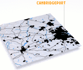 Places with similar names to Cambridgeport, United States - USA ::
// Cambridgeport (US)
Disclaimer :: Information on this page comes without warranty of any kind |
||
|
Where is Cambridgeport? Elevation and coordinates ::
Latitude (lat): 42°21'30"N Longitude (lon): 71°6'15"W
Elevation (approx.): 8m (map arrows pan, magnifying glasses zoom) |
||
|
Visiting Cambridgeport? Hotel/Accommodation ::
Book a hotel in Cambridgeport Travel Guide ::
rental cars ::
car rental offers GPS waypoint ::
download a GPX waypoint (PoI) of Cambridgeport for your GPS receiver
|
||