|
search place name
|
||
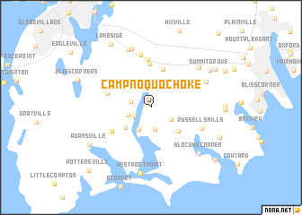
Camp Noquochoke (Massachusetts, United States - USA)Camp Noquochoke is a town in the Massachusetts region of United States - USA. An overview map of the region around Camp Noquochoke is displayed below.
regional and 3d topo map of Camp Noquochoke, United States - USA ::
Camp Noquochoke airports ::
The nearest airport is PVD - Providence Theodore Francis Green State, located 33.4 km north west of Camp Noquochoke.
Other airports nearby include BOS - Boston General Edward Lawrence Logan Intl (85.5 km north), ACK - Nantucket Mem (92.1 km south east), BED - Bedford Laurence G Hanscom Fld (98.9 km north), HFD - Hartford Brainard (133.0 km west), Nearby towns ::
Snell Corner (1.9km south west) //
Kirby Corner (2.0km west) //
Head of Westport (2.8km north) //
South Westport (2.8km south) //
Sissons Corner (2.8km north) //
Booth Corner (2.3km south west) //
Gidleys Corner (2.5km south east) //
Handy Four Corners (3.0km south) //
Giffords Corner (3.3km north west) //
Central Village (3.4km south west) //
Slades Corner (3.9km south east) //
Westport Factory (4.9km north) //
Suburban Park (5.4km north) //
Brownell Corner (4.7km north west) //
Macombers Corner (4.7km south west) //
Woods Corner (4.4km north west) //
Berryman Corner (6.0km north) //
Hillcrest (6.6km north) //
Russells Mills (5.4km south east) //
University Highlands (6.0km north east) //
Beulah Corners (7.5km north) //
North Westport (7.5km north) //
Kempton Croft (6.7km north east) //
Slocums Corner (7.2km south east) //
Westport Point (8.2km south) //
Summit Grove (7.2km north east) //
Adamsville (7.3km south west) //
Smith Mills (7.6km north east) //
Lakeside (8.7km north west) //
[all distances 'as the bird flies' and approximate]  Places with similar names to Camp Noquochoke, United States - USA ::
// Kampong Siak (MY)
// Kampong Tiak (MY)
// Kampong Tiak (MY)
// Kampong Chagah (MY)
// Kampong Chiak (MY)
// Kampong Chogu (MY)
Disclaimer :: Information on this page comes without warranty of any kind |
||
|
Where is Camp Noquochoke? Elevation and coordinates ::
Latitude (lat): 41°35'45"N Longitude (lon): 71°3'48"W
Elevation (approx.): 9m (map arrows pan, magnifying glasses zoom) |
||
|
Visiting Camp Noquochoke? Hotel/Accommodation ::
Book a hotel in Camp Noquochoke Travel Guide ::
rental cars ::
car rental offers GPS waypoint ::
download a GPX waypoint (PoI) of Camp Noquochoke for your GPS receiver
|
||