|
search place name
|
||
Clarendon Hills (Massachusetts, United States - USA)Clarendon Hills is a town in the Massachusetts region of United States - USA. An overview map of the region around Clarendon Hills is displayed below.
regional and 3d topo map of Clarendon Hills, United States - USA ::

nearby GPS traces from timatio ::
Clarendon Hills airports ::
The nearest airport is BOS - Boston General Edward Lawrence Logan Intl, located 14.0 km north east of Clarendon Hills.
Other airports nearby include BED - Bedford Laurence G Hanscom Fld (25.5 km north west), PVD - Providence Theodore Francis Green State (65.0 km south), CEF - Chicopee Falls Westover Arb Metropolitan (116.7 km west), BDL - Windsor Locks Bradley Intl (134.2 km west), Nearby towns ::
Clarendon Hills (0.1km east) //
Mount Hope (0.9km north) //
Roslindale (1.8km north) //
Hyde Park (2.2km south) //
Bellevue (2.2km north west) //
Forest Hills (2.6km north east) //
West Roxbury (2.1km west) //
Fairmount (2.7km south) //
Stonybrook Village (2.9km south west) //
Forest Hills (3.0km north east) //
Germantown (2.8km south west) //
Milton Upper Mills (2.9km south east) //
Highland (2.9km north west) //
Jamaica Plain (3.9km north) //
Readville (4.0km south) //
Mattapan (3.1km east) //
Westbrook Village (3.7km north west) //
Blue Hills (4.2km south east) //
East Dedham (3.9km south west) //
Oakdale (4.5km south west) //
Newstead Montegrade (4.7km north east) //
Ashcroft (5.1km south west) //
Milton Center (4.3km south east) //
Readville Manor (5.3km south) //
Camp Sayre (5.3km south east) //
Riverdale (4.4km west) //
Dedham (5.0km south west) //
Milton Village (4.4km east) //
Dedham Island (4.4km west) //
[all distances 'as the bird flies' and approximate] 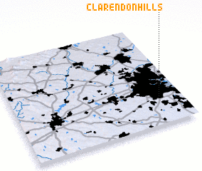 Places with similar names to Clarendon Hills, United States - USA ::
// Clarendon Hills (US)
// Clarendon Hills (US)
Disclaimer :: Information on this page comes without warranty of any kind |
||
|
Where is Clarendon Hills? Elevation and coordinates ::
Latitude (lat): 42°16'30"N Longitude (lon): 71°7'30"W
Elevation (approx.): 43m (map arrows pan, magnifying glasses zoom) |
||
|
Visiting Clarendon Hills? Hotel/Accommodation ::
Book a hotel in Clarendon Hills Travel Guide ::
rental cars ::
car rental offers GPS waypoint ::
download a GPX waypoint (PoI) of Clarendon Hills for your GPS receiver
|
||