|
search place name
|
||
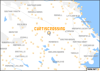
Curtis Crossing (Massachusetts, United States - USA)Curtis Crossing is a town in the Massachusetts region of United States - USA. An overview map of the region around Curtis Crossing is displayed below.
regional and 3d topo map of Curtis Crossing, United States - USA ::
Curtis Crossing airports ::
The nearest airport is BOS - Boston General Edward Lawrence Logan Intl, located 32.7 km north west of Curtis Crossing.
Other airports nearby include BED - Bedford Laurence G Hanscom Fld (56.0 km north west), PVD - Providence Theodore Francis Green State (64.4 km south west), ACK - Nantucket Mem (113.8 km south east), CEF - Chicopee Falls Westover Arb Metropolitan (141.8 km west), Nearby towns ::
Hanover (1.5km north east) //
Hanover Center (2.1km north west) //
Schoosett (2.1km east) //
South Hanover (2.3km west) //
Oldham Pines (3.4km south) //
Wingbrook Estates (2.9km south west) //
North Pembroke (2.7km south east) //
Riverwind Estates (3.0km south west) //
Pembroke (3.7km south) //
Oldham Village (4.0km south) //
Winslows Crossing (3.7km west) //
Mercer Square (4.4km north west) //
Fireworks (4.0km west) //
Camp Kiwanis (5.4km south west) //
Camp Wampatuck (5.4km south west) //
Golden Ring Camp (6.1km south) //
Town Hall (5.5km south west) //
Brimstone Corner (5.9km south east) //
Manns Corner (5.9km north west) //
North Hanover (6.0km north west) //
West Hanover (5.3km west) //
Bryantville (6.7km south) //
Assinippi (6.6km north) //
Hanson (5.6km south west) //
Mayflower Grove (7.0km south) //
East Pembroke (5.7km south east) //
Norwell (7.0km north) //
Jacobs Lake Shores (7.0km north) //
North Marshfield (6.2km north east) //
[all distances 'as the bird flies' and approximate] 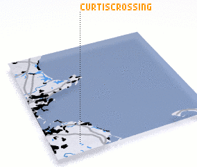 Places with similar names to Curtis Crossing, United States - USA ::
// Carretas Crossing (US)
Disclaimer :: Information on this page comes without warranty of any kind |
||
|
Where is Curtis Crossing? Elevation and coordinates ::
Latitude (lat): 42°6'10"N Longitude (lon): 70°49'25"W
Elevation (approx.): 14m (map arrows pan, magnifying glasses zoom) |
||
|
Visiting Curtis Crossing? Hotel/Accommodation ::
Book a hotel in Curtis Crossing Travel Guide ::
rental cars ::
car rental offers GPS waypoint ::
download a GPX waypoint (PoI) of Curtis Crossing for your GPS receiver
|
||