|
search place name
|
||
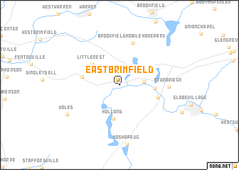
East Brimfield (Massachusetts, United States - USA)East Brimfield is a town in the Massachusetts region of United States - USA. An overview map of the region around East Brimfield is displayed below.
regional and 3d topo map of East Brimfield, United States - USA ::
East Brimfield airports ::
The nearest airport is CEF - Chicopee Falls Westover Arb Metropolitan, located 33.2 km west of East Brimfield.
Other airports nearby include BDL - Windsor Locks Bradley Intl (48.2 km south west), HFD - Hartford Brainard (58.8 km south west), PVD - Providence Theodore Francis Green State (73.6 km south east), BED - Bedford Laurence G Hanscom Fld (81.3 km north east), Nearby towns ::
Fiskdale (2.9km east) //
Holland (5.3km south) //
Little Rest (4.6km north west) //
Old Sturbridge Village (4.1km east) //
Brimfield (4.5km west) //
Robinson Crusoe Camp (4.8km south east) //
Brookfield Mobile Home Park (6.8km north) //
Sturbridge (5.8km east) //
Wales (7.7km south west) //
[all distances 'as the bird flies' and approximate] 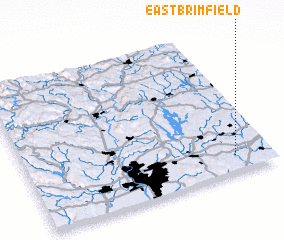 Places with similar names to East Brimfield, United States - USA :: Disclaimer :: Information on this page comes without warranty of any kind |
||
|
Where is East Brimfield? Elevation and coordinates ::
Latitude (lat): 42°6'40"N Longitude (lon): 72°8'56"W
Elevation (approx.): 202m (map arrows pan, magnifying glasses zoom) |
||
|
Visiting East Brimfield? Hotel/Accommodation ::
Book a hotel in East Brimfield Travel Guide ::
rental cars ::
car rental offers GPS waypoint ::
download a GPX waypoint (PoI) of East Brimfield for your GPS receiver
|
||