|
search place name
|
||
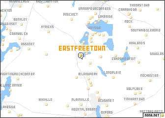
East Freetown (Massachusetts, United States - USA)East Freetown is a town in the Massachusetts region of United States - USA. An overview map of the region around East Freetown is displayed below.
regional and 3d topo map of East Freetown, United States - USA ::
East Freetown airports ::
The nearest airport is PVD - Providence Theodore Francis Green State, located 38.7 km west of East Freetown.
Other airports nearby include BOS - Boston General Edward Lawrence Logan Intl (65.6 km north), BED - Bedford Laurence G Hanscom Fld (81.9 km north), ACK - Nantucket Mem (94.8 km south east), CEF - Chicopee Falls Westover Arb Metropolitan (138.7 km west), Nearby towns ::
Heaven Heights (1.4km north east) //
Pine Haven (1.8km north) //
Masons Corner (1.6km south east) //
Hilltop Acres (2.6km north) //
Lakeview Heights (2.9km north) //
Churchill Shores (3.4km north) //
Canedys Corner (3.3km north west) //
Lakeside Shore (3.1km north east) //
Buena Vista Shores (3.9km north) //
Ashley Heights (3.1km east) //
Braleys (4.3km south) //
Hemlocks (4.3km north) //
Inland Park (4.6km south) //
Fuller Shores (5.0km north) //
Huckleberry Shores (5.4km north) //
Clifford (5.6km south) //
Nelsons Shores (5.8km north) //
Westgate Park (6.2km south) //
Wayside (6.4km north) //
Pine Bluffs (6.3km north east) //
Pine Hill Acres (6.9km south) //
Indian Shore (6.5km north east) //
North Rochester (5.7km east) //
Lakeville (7.9km north) //
Long Plain (6.7km south east) //
Buffington Corner (6.2km west) //
Sherwood Forest (8.0km south) //
Sampsons Corner (8.4km north) //
Nelsons Grove (8.5km north) //
[all distances 'as the bird flies' and approximate] 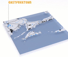 Places with similar names to East Freetown, United States - USA ::
// East Freetown (US)
// East Fortune (GB)
Disclaimer :: Information on this page comes without warranty of any kind |
||
|
Where is East Freetown? Elevation and coordinates ::
Latitude (lat): 41°46'30"N Longitude (lon): 70°57'30"W
Elevation (approx.): 27m (map arrows pan, magnifying glasses zoom) |
||
|
Visiting East Freetown? Hotel/Accommodation ::
Book a hotel in East Freetown Travel Guide ::
rental cars ::
car rental offers GPS waypoint ::
download a GPX waypoint (PoI) of East Freetown for your GPS receiver
|
||