|
search place name
|
||
Millbury (Massachusetts, United States - USA)Millbury is a town in the Massachusetts region of United States - USA. An overview map of the region around Millbury is displayed below.
regional and 3d topo map of Millbury, United States - USA ::

Millbury airports ::
The nearest airport is BED - Bedford Laurence G Hanscom Fld, located 49.5 km north east of Millbury.
Other airports nearby include PVD - Providence Theodore Francis Green State (58.5 km south east), CEF - Chicopee Falls Westover Arb Metropolitan (63.9 km west), BOS - Boston General Edward Lawrence Logan Intl (65.1 km east), BDL - Windsor Locks Bradley Intl (81.4 km west), Nearby towns ::
Bramanville (1.7km south west) //
Dorothy Manor (2.6km north) //
Dorothy Pond (3.0km north) //
Old Common (2.3km south west) //
East Millbury (4.0km north) //
Oakland Heights (3.8km north west) //
Whispering Pines Estates Mobile Home Park (3.5km north west) //
Marions Camp (4.4km south) //
Sutton (4.9km south) //
Wilkinsonville (3.9km south east) //
South Grafton Street (5.2km north) //
Maplewood (4.7km north east) //
Millbury Junction (5.1km north east) //
West Millbury (4.4km south west) //
Windbrook Acres Mobile Home Park (4.4km north west) //
Massasoit (5.4km north) //
Quinsigamond Village (5.0km north west) //
Sunderland (5.7km north) //
Saundersville (4.8km east) //
Edgemere (6.3km north) //
Rice Square (6.2km north) //
Pinecrest (6.6km north) //
Pondville (5.1km west) //
Pakachoag (5.6km north west) //
Hamilton (6.9km north) //
Vernon Hill (6.5km north west) //
College Hill (6.0km north west) //
Union Hill (6.9km north) //
North Grafton (6.1km north east) //
[all distances 'as the bird flies' and approximate] 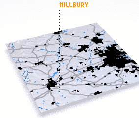 Places with similar names to Millbury, United States - USA ::
Disclaimer :: Information on this page comes without warranty of any kind |
||
|
Where is Millbury? Elevation and coordinates ::
Latitude (lat): 42°11'38"N Longitude (lon): 71°45'38"W
Elevation (approx.): 129m (map arrows pan, magnifying glasses zoom) |
||
|
Visiting Millbury? Hotel/Accommodation ::
Book a hotel in Millbury Travel Guide ::
rental cars ::
car rental offers GPS waypoint ::
download a GPX waypoint (PoI) of Millbury for your GPS receiver
|
||