|
search place name
|
||
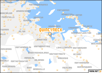
Quincy Neck (Massachusetts, United States - USA)Quincy Neck is a town in the Massachusetts region of United States - USA. An overview map of the region around Quincy Neck is displayed below.
regional and 3d topo map of Quincy Neck, United States - USA ::
nearby GPS traces from timatio ::
Quincy Neck airports ::
The nearest airport is BOS - Boston General Edward Lawrence Logan Intl, located 14.0 km north of Quincy Neck.
Other airports nearby include BED - Bedford Laurence G Hanscom Fld (36.5 km north west), PVD - Providence Theodore Francis Green State (67.7 km south west), CEF - Chicopee Falls Westover Arb Metropolitan (129.2 km west), ACK - Nantucket Mem (133.3 km south east), Nearby towns ::
Old Boat Point (0.4km south west) //
Quincy Point (1.2km north west) //
East Braintree (1.8km south) //
Germantown (1.7km north east) //
South Commons (1.4km west) //
Idlewell (1.7km south east) //
Weymouth Landing (2.1km south) //
Post Island (2.4km north) //
Rock Island (2.4km north) //
North Weymouth (2.0km east) //
Adams Shore (2.8km north west) //
Old Spain (2.2km east) //
Weymouth Heights (2.4km south east) //
Houghs Neck (3.0km north) //
Merrymount (3.1km north west) //
Quincy (2.9km north west) //
Braintree (3.2km south west) //
Weymouth (3.4km south east) //
South Quincy (3.1km west) //
Quincy Center (3.1km west) //
North Commons (3.8km west) //
South Braintree (5.2km south west) //
Five Corners (4.3km west) //
Lincoln Heights (4.7km south east) //
Wollaston (4.9km north west) //
East Weymouth (5.1km south east) //
Norfolk Downs (5.4km north west) //
North Quincy (5.7km north west) //
Lovell Corners (6.1km south east) //
[all distances 'as the bird flies' and approximate]  Places with similar names to Quincy Neck, United States - USA ::
Disclaimer :: Information on this page comes without warranty of any kind |
||
|
Where is Quincy Neck? Elevation and coordinates ::
Latitude (lat): 42°14'28"N Longitude (lon): 70°58'15"W
Elevation (approx.): -4m (map arrows pan, magnifying glasses zoom) |
||
|
Visiting Quincy Neck? Hotel/Accommodation ::
Book a hotel in Quincy Neck Travel Guide ::
rental cars ::
car rental offers GPS waypoint ::
download a GPX waypoint (PoI) of Quincy Neck for your GPS receiver
|
||