|
search place name
|
||
Waterville (Massachusetts, United States - USA)Waterville is a town in the Massachusetts region of United States - USA. An overview map of the region around Waterville is displayed below.
regional and 3d topo map of Waterville, United States - USA ::

Waterville airports ::
The nearest airport is BOS - Boston General Edward Lawrence Logan Intl, located 51.5 km north of Waterville.
Other airports nearby include PVD - Providence Theodore Francis Green State (52.3 km south west), BED - Bedford Laurence G Hanscom Fld (71.7 km north west), ACK - Nantucket Mem (98.4 km south east), CEF - Chicopee Falls Westover Arb Metropolitan (143.5 km west), Nearby towns ::
Eddyville (1.0km north west) //
Prospect Hill (3.3km north east) //
Nemasket (3.3km west) //
North Carver (3.4km east) //
Thomastown (4.6km south) //
Cole Mill (3.6km east) //
Plympton (4.5km north east) //
The Green (3.9km west) //
South Halifax (4.8km north west) //
Gibbs Grove (5.7km south) //
Maxim Corner (5.3km south east) //
Camp Avoda (6.0km south) //
Water View Village (4.7km east) //
Camp Yomechas (6.5km south) //
Shutleff Corner (6.0km east) //
Middleboro (6.4km south west) //
Wenham (6.2km east) //
Warrentown (6.3km west) //
Halifax Mobile Home Estates (8.5km north) //
Halifax (8.4km north) //
Rock (8.5km south) //
North Plympton (8.4km north) //
Harrubs Corner (8.5km north) //
Carver (7.5km south east) //
Lakeside (9.2km south west) //
[all distances 'as the bird flies' and approximate] 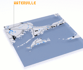 Places with similar names to Waterville, United States - USA ::
// Water Valley (US)
// Waterfall (US)
// Waterville (US)
// Watervale (US)
// Waterville (US)
// Water Valley (US)
// Waterville (US)
// Water Fall (ZA)
// Waterval (ZA)
// Waterval (ZA)
Disclaimer :: Information on this page comes without warranty of any kind |
||
|
Where is Waterville? Elevation and coordinates ::
Latitude (lat): 41°55'1"N Longitude (lon): 70°50'29"W
Elevation (approx.): 48m (map arrows pan, magnifying glasses zoom) |
||
|
Visiting Waterville? Hotel/Accommodation ::
Book a hotel in Waterville Travel Guide ::
rental cars ::
car rental offers GPS waypoint ::
download a GPX waypoint (PoI) of Waterville for your GPS receiver
|
||