|
search place name
|
||
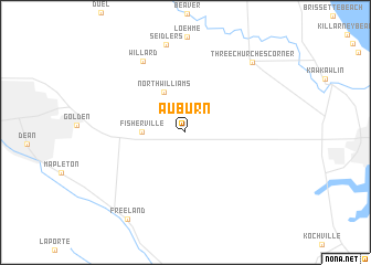
Auburn (Michigan, United States - USA)Auburn is a town in the Michigan region of United States - USA. An overview map of the region around Auburn is displayed below.
regional and 3d topo map of Auburn, United States - USA ::
Auburn airports ::
The nearest airport is LAN - Lansing Capital City, located 100.8 km south west of Auburn.
Other airports nearby include GRR - Grand Rapids Gerald R Ford Intl (142.7 km south west), MTC - Mount Clemens Selfridge Angb (149.4 km south east), YZR - Sarnia Chris Hadfield (157.8 km south east), YIP - Detroit Willow Run (157.9 km south), Nearby towns ::
Fisherville (3.2km west) //
North Williams (4.3km north) //
Willard (7.9km north west) //
Seidlers (9.0km north) //
Three Churches Corner (8.7km north east) //
Freeland (9.7km south west) //
[all distances 'as the bird flies' and approximate] 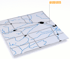 Places with similar names to Auburn, United States - USA ::
Disclaimer :: Information on this page comes without warranty of any kind |
||
|
Where is Auburn? Elevation and coordinates ::
Latitude (lat): 43°36'12"N Longitude (lon): 84°4'11"W
Elevation (approx.): 189m (map arrows pan, magnifying glasses zoom) |
||
|
Visiting Auburn? Hotel/Accommodation ::
Book a hotel in Auburn Travel Guide ::
rental cars ::
car rental offers GPS waypoint ::
download a GPX waypoint (PoI) of Auburn for your GPS receiver
|
||