|
search place name
|
||
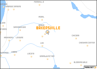
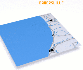
Bakersville (Michigan, United States - USA)Bakersville is a town in the Michigan region of United States - USA. An overview map of the region around Bakersville is displayed below.
regional and 3d topo map of Bakersville, United States - USA ::
Bakersville airports ::
The nearest airport is GRR - Grand Rapids Gerald R Ford Intl, located 62.4 km north east of Bakersville.
Other airports nearby include LAN - Lansing Capital City (125.7 km east), MKE - Milwaukee General Mitchell Intl (158.0 km west), MDW - Chicago Midway Intl (159.6 km south west), ORD - Chicago Ohare Intl (161.8 km west), Nearby towns ::
 Places with similar names to Bakersville, United States - USA ::
// Bakersville (US)
// Bakersville (US)
// Bakersville (US)
// Biggersville (US)
// Bakersville (US)
// Bakersville (US)
// Bakersville (US)
// Bakersville (US)
// Bakersville (US)
// Beckersville (US)
Disclaimer :: Information on this page comes without warranty of any kind |
||
|
Where is Bakersville? Elevation and coordinates ::
Latitude (lat): 42°29'24"N Longitude (lon): 86°4'11"W
Elevation (approx.): 205m (map arrows pan, magnifying glasses zoom) |
||
|
Visiting Bakersville? Hotel/Accommodation ::
Book a hotel in Bakersville Travel Guide ::
rental cars ::
car rental offers GPS waypoint ::
download a GPX waypoint (PoI) of Bakersville for your GPS receiver
|
||