|
search place name
|
||
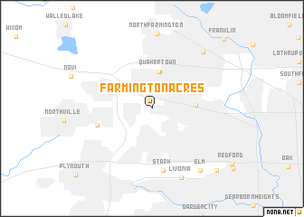
Farmington Acres (Michigan, United States - USA)Farmington Acres is a town in the Michigan region of United States - USA. An overview map of the region around Farmington Acres is displayed below.
regional and 3d topo map of Farmington Acres, United States - USA ::
Farmington Acres airports ::
The nearest airport is YIP - Detroit Willow Run, located 25.9 km south west of Farmington Acres.
Other airports nearby include DTW - Detroit Metro Wayne Co (26.0 km south), DET - Detroit Coleman A Young Muni (31.2 km east), YQG - Windsor (40.1 km south east), MTC - Mount Clemens Selfridge Angb (48.7 km east), Nearby towns ::
Farmington (2.3km north) //
Farmington Hills (4.5km north) //
Quakertown (4.6km north) //
Clarenceville (4.0km east) //
Grand View Acres (5.4km south west) //
Stark (7.8km south) //
Livonia (8.9km south) //
Wood Creek Farms (8.4km north east) //
Elm (8.8km south east) //
Norton (9.6km south east) //
Franklin (10.8km north east) //
[all distances 'as the bird flies' and approximate] 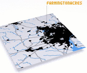 Places with similar names to Farmington Acres, United States - USA ::
// Farmington Acres (US)
Disclaimer :: Information on this page comes without warranty of any kind |
||
|
Where is Farmington Acres? Elevation and coordinates ::
Latitude (lat): 42°26'42"N Longitude (lon): 83°23'8"W
Elevation (approx.): 219m (map arrows pan, magnifying glasses zoom) |
||
|
Visiting Farmington Acres? Hotel/Accommodation ::
Book a hotel in Farmington Acres Travel Guide ::
rental cars ::
car rental offers GPS waypoint ::
download a GPX waypoint (PoI) of Farmington Acres for your GPS receiver
|
||