|
search place name
|
||
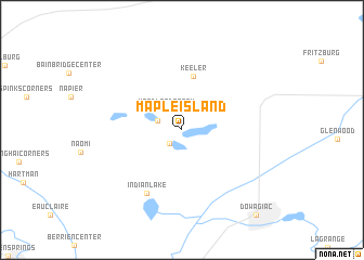
Maple Island (Michigan, United States - USA)Maple Island is a town in the Michigan region of United States - USA. An overview map of the region around Maple Island is displayed below.
regional and 3d topo map of Maple Island, United States - USA ::
Maple Island airports ::
The nearest airport is GRR - Grand Rapids Gerald R Ford Intl, located 105.6 km north east of Maple Island.
Other airports nearby include MDW - Chicago Midway Intl (134.2 km west), ORD - Chicago Ohare Intl (143.4 km west), LAN - Lansing Capital City (153.1 km north east), GUS - Peru Grissom Arb (157.2 km south), Nearby towns ::
Sandy Beach (1.6km south west) //
Woodland Beach (2.4km north west) //
Sister Lakes (2.1km north west) //
Keeler (5.6km north) //
Indian Lake (7.0km south) //
Dowagiac (10.5km south east) //
[all distances 'as the bird flies' and approximate] 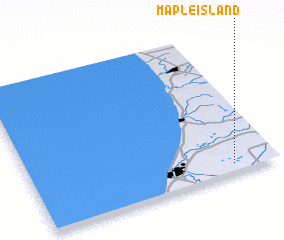 Places with similar names to Maple Island, United States - USA ::
// Maple Island (US)
// Maple Island (US)
Disclaimer :: Information on this page comes without warranty of any kind |
||
|
Where is Maple Island? Elevation and coordinates ::
Latitude (lat): 42°3'48"N Longitude (lon): 86°10'38"W
Elevation (approx.): 238m (map arrows pan, magnifying glasses zoom) |
||
|
Visiting Maple Island? Hotel/Accommodation ::
Book a hotel in Maple Island Travel Guide ::
rental cars ::
car rental offers GPS waypoint ::
download a GPX waypoint (PoI) of Maple Island for your GPS receiver
|
||