|
search place name
|
||
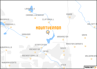
Mount Vernon (Michigan, United States - USA)Mount Vernon is a town in the Michigan region of United States - USA. An overview map of the region around Mount Vernon is displayed below.
regional and 3d topo map of Mount Vernon, United States - USA ::
Mount Vernon airports ::
The nearest airport is MTC - Mount Clemens Selfridge Angb, located 25.4 km south east of Mount Vernon.
Other airports nearby include DET - Detroit Coleman A Young Muni (37.5 km south), YQG - Windsor (52.9 km south), DTW - Detroit Metro Wayne Co (62.8 km south), YIP - Detroit Willow Run (66.8 km south west), Nearby towns ::
Clifton Mill (4.8km north) //
Stony Creek (5.5km south) //
Washington (4.6km south east) //
Yates (7.6km south) //
Campbells Corner (7.5km north west) //
Goodison (6.3km west) //
Rochester (7.8km south west) //
Disco (7.8km south east) //
Shelby (9.1km south east) //
Romeo (9.1km north east) //
Lakeville (10.2km north west) //
[all distances 'as the bird flies' and approximate] 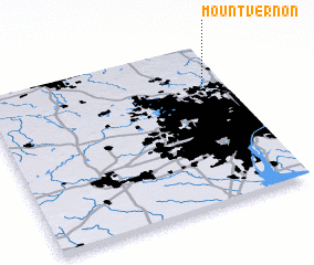 Places with similar names to Mount Vernon, United States - USA ::
// Mount Vernon (US)
// Mount Vernon (US)
// Mount Vernon (US)
// Mount Vernon (US)
// Mount Vernon (US)
// Mount Vernon (US)
// Mount Vernon (US)
// Mount Vernon (US)
// Mount Vernon (US)
// Mount Vernon (US)
Disclaimer :: Information on this page comes without warranty of any kind |
||
|
Where is Mount Vernon? Elevation and coordinates ::
Latitude (lat): 42°44'31"N Longitude (lon): 83°5'13"W
Elevation (approx.): 257m (map arrows pan, magnifying glasses zoom) |
||
|
Visiting Mount Vernon? Hotel/Accommodation ::
Book a hotel in Mount Vernon Travel Guide ::
rental cars ::
car rental offers GPS waypoint ::
download a GPX waypoint (PoI) of Mount Vernon for your GPS receiver
|
||