|
search place name
|
||
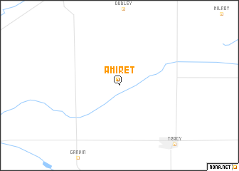
Amiret (Minnesota, United States - USA)Amiret is a town in the Minnesota region of United States - USA. An overview map of the region around Amiret is displayed below.
regional and 3d topo map of Amiret, United States - USA ::
Amiret airports ::
The nearest airport is SUX - Sioux City Sioux Gateway Col Bud Day Fld, located 219.8 km south of Amiret.
Other airports nearby include FOD - Fort Dodge Rgnl (230.9 km south east), Nearby towns ::
[all distances 'as the bird flies' and approximate]  Places with similar names to Amiret, United States - USA ::
// Amerete (BO)
// Ammeroid (AT)
// Aia Murata (IT)
// Amarito (CU)
// Amarat (TR)
// Amárita (ES)
// Ambaiorata (MG)
// Amīr Deh (IR)
// Amīr Rūd (IR)
// Āmardi (BD)
Disclaimer :: Information on this page comes without warranty of any kind |
||
|
Where is Amiret? Elevation and coordinates ::
Latitude (lat): 44°19'0"N Longitude (lon): 95°41'48"W
Elevation (approx.): 388m (map arrows pan, magnifying glasses zoom) |
||
|
Visiting Amiret? Hotel/Accommodation ::
Book a hotel in Amiret Travel Guide ::
rental cars ::
car rental offers GPS waypoint ::
download a GPX waypoint (PoI) of Amiret for your GPS receiver
|
||