|
search place name
|
||
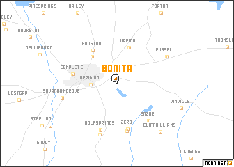
Bonita (Mississippi, United States - USA)Bonita is a town in the Mississippi region of United States - USA. An overview map of the region around Bonita is displayed below.
regional and 3d topo map of Bonita, United States - USA ::
Bonita airports ::
The nearest airport is NMM - Meridian Nas, located 23.2 km north east of Bonita.
Other airports nearby include JAN - Jackson Evers Intl (132.9 km west), CBM - Colombus Columbus Afb (143.3 km north), GWO - Greenwood Leflore (182.4 km north west), MOB - Mobile Rgnl (189.9 km south), Nearby towns ::
Meridian (3.6km west) //
Poplar Springs (5.4km north west) //
Marion (6.0km north) //
Houston (6.2km north west) //
Complete (6.1km west) //
Zero (7.4km south) //
Enzor (7.4km south east) //
Pleasant Hill (7.8km south) //
Wolf Springs (7.8km south) //
Stinson (8.6km south) //
Savannah Grove (7.7km west) //
Russell (8.0km north east) //
Cliff Williams (9.7km south east) //
[all distances 'as the bird flies' and approximate] 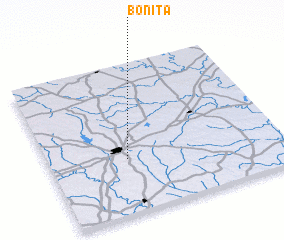 Places with similar names to Bonita, United States - USA ::
Disclaimer :: Information on this page comes without warranty of any kind |
||
|
Where is Bonita? Elevation and coordinates ::
Latitude (lat): 32°21'55"N Longitude (lon): 88°39'57"W
Elevation (approx.): 110m (map arrows pan, magnifying glasses zoom) |
||
|
Visiting Bonita? Hotel/Accommodation ::
Book a hotel in Bonita Travel Guide ::
rental cars ::
car rental offers GPS waypoint ::
download a GPX waypoint (PoI) of Bonita for your GPS receiver
|
||