|
search place name
|
||
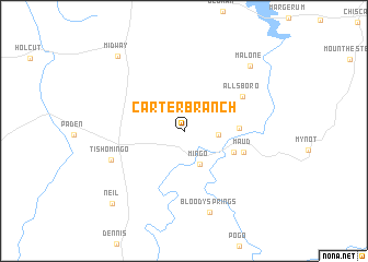
Carter Branch (Mississippi, United States - USA)Carter Branch is a town in the Mississippi region of United States - USA. An overview map of the region around Carter Branch is displayed below.
regional and 3d topo map of Carter Branch, United States - USA ::
Carter Branch airports ::
The nearest airport is CBM - Colombus Columbus Afb, located 115.9 km south of Carter Branch.
Other airports nearby include MKL - Jackson Mc Kellar Sipes Rgnl (124.5 km north west), HUA - Redstone Aaf (135.6 km east), MEM - Memphis Intl (171.0 km west), NQA - Millington Rgnl Jetport (173.7 km north west), Nearby towns ::
Petertown (2.9km east) //
Mingo (3.7km south) //
Burnstown (4.7km south east) //
Bishop (4.6km east) //
Maud (5.5km south east) //
Allsboro (6.1km north east) //
Tishomingo (6.8km south west) //
Bloody Springs (8.6km south) //
Malone (8.7km north east) //
Midway (9.4km north west) //
Neil (9.6km south west) //
[all distances 'as the bird flies' and approximate] 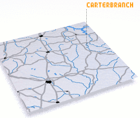 Places with similar names to Carter Branch, United States - USA :: Disclaimer :: Information on this page comes without warranty of any kind |
||
|
Where is Carter Branch? Elevation and coordinates ::
Latitude (lat): 34°39'46"N Longitude (lon): 88°9'52"W
Elevation (approx.): 179m (map arrows pan, magnifying glasses zoom) |
||
|
Visiting Carter Branch? Hotel/Accommodation ::
Book a hotel in Carter Branch Travel Guide ::
rental cars ::
car rental offers GPS waypoint ::
download a GPX waypoint (PoI) of Carter Branch for your GPS receiver
|
||