|
search place name
|
||
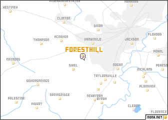
Forest Hill (Mississippi, United States - USA)Forest Hill is a town in the Mississippi region of United States - USA. An overview map of the region around Forest Hill is displayed below.
regional and 3d topo map of Forest Hill, United States - USA ::
Forest Hill airports ::
The nearest airport is JAN - Jackson Evers Intl, located 20.0 km east of Forest Hill.
Other airports nearby include GWO - Greenwood Leflore (137.5 km north), NMM - Meridian Nas (165.4 km east), MLU - Monroe Rgnl (167.5 km west), BTR - Baton Rouge Metro Ryan Fld (209.1 km south west), Nearby towns ::
Siwel (2.9km south west) //
Bradie (3.2km north east) //
Van Winkle (4.0km north east) //
Mayfair (6.0km south east) //
Taylorsville (5.9km south east) //
McRaven (6.1km north west) //
Brookleigh (7.1km south) //
Dixon (7.2km north) //
Nogan (6.7km east) //
Elton (7.6km south east) //
New Byram (9.1km south) //
Clinton (9.3km north west) //
Spring Ridge (9.8km south west) //
[all distances 'as the bird flies' and approximate]  Places with similar names to Forest Hill, United States - USA ::
// Forest Hill (US)
// Foresthill (US)
// Forest Hill (US)
// Forest Hill (US)
// Forest Hill (US)
// Forest Hill (US)
// Forest Hill (US)
// Forest Hill (US)
// Frost Hollow (US)
// Forest Hill (US)
Disclaimer :: Information on this page comes without warranty of any kind |
||
|
Where is Forest Hill? Elevation and coordinates ::
Latitude (lat): 32°15'55"N Longitude (lon): 90°16'51"W
Elevation (approx.): 130m (map arrows pan, magnifying glasses zoom) |
||
|
Visiting Forest Hill? Hotel/Accommodation ::
Book a hotel in Forest Hill Travel Guide ::
rental cars ::
car rental offers GPS waypoint ::
download a GPX waypoint (PoI) of Forest Hill for your GPS receiver
|
||