|
search place name
|
||
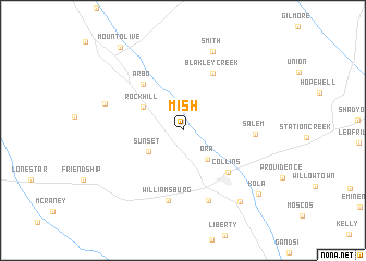
Mish (Mississippi, United States - USA)Mish is a town in the Mississippi region of United States - USA. An overview map of the region around Mish is displayed below.
regional and 3d topo map of Mish, United States - USA ::
Mish airports ::
The nearest airport is JAN - Jackson Evers Intl, located 83.0 km north west of Mish.
Other airports nearby include NMM - Meridian Nas (137.6 km north east), BIX - Biloxi Keesler Afb (155.1 km south east), MOB - Mobile Rgnl (169.6 km south east), BFM - Mobile Downtown (187.1 km south east), Nearby towns ::
Ora (3.6km south east) //
Sunset (3.7km south west) //
Rock Hill (4.2km north west) //
Arbo (5.9km north west) //
Collins (5.8km south east) //
Blakley Creek (6.4km north east) //
Williamsburg (7.3km south) //
Salem (6.3km east) //
McDonald (7.5km south) //
Cooley Springs (7.3km west) //
Smith (8.5km north) //
Cold Springs (8.8km south east) //
Kola (9.3km south east) //
Mount Olive (10.2km north west) //
[all distances 'as the bird flies' and approximate] 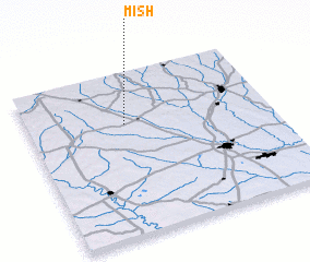 Places with similar names to Mish, United States - USA ::
Disclaimer :: Information on this page comes without warranty of any kind |
||
|
Where is Mish? Elevation and coordinates ::
Latitude (lat): 31°41'2"N Longitude (lon): 89°35'50"W
Elevation (approx.): 95m (map arrows pan, magnifying glasses zoom) |
||
|
Visiting Mish? Hotel/Accommodation ::
Book a hotel in Mish Travel Guide ::
rental cars ::
car rental offers GPS waypoint ::
download a GPX waypoint (PoI) of Mish for your GPS receiver
|
||