|
search place name
|
||
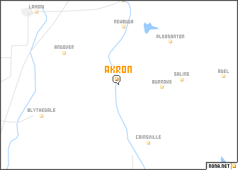
Akron (Missouri, United States - USA)Akron is a town in the Missouri region of United States - USA. An overview map of the region around Akron is displayed below.
regional and 3d topo map of Akron, United States - USA ::
Akron airports ::
The nearest airport is DSM - Des Moines Intl, located 113.4 km north of Akron.
Other airports nearby include MCI - Kansas City Intl (155.8 km south west), FLV - Fort Leavenworth Sherman Aaf (158.5 km south west), SZL - Knobnoster Whiteman Afb (200.0 km south), COU - Columbia Rgnl (233.4 km south east), Nearby towns ::
Burrows (5.2km east) //
Andover (8.3km north west) //
Pleasanton (9.2km north east) //
[all distances 'as the bird flies' and approximate] 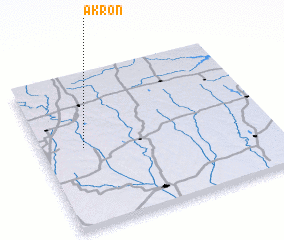 Places with similar names to Akron, United States - USA ::
Disclaimer :: Information on this page comes without warranty of any kind |
||
|
Where is Akron? Elevation and coordinates ::
Latitude (lat): 40°31'10"N Longitude (lon): 93°49'2"W
Elevation (approx.): 267m (map arrows pan, magnifying glasses zoom) |
||
|
Visiting Akron? Hotel/Accommodation ::
Book a hotel in Akron Travel Guide ::
rental cars ::
car rental offers GPS waypoint ::
download a GPX waypoint (PoI) of Akron for your GPS receiver
|
||