|
search place name
|
||
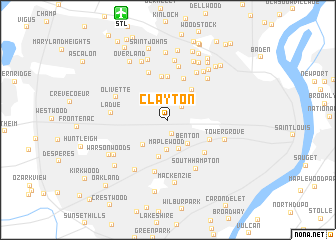
Clayton (Missouri, United States - USA)Clayton is a town in the Missouri region of United States - USA. An overview map of the region around Clayton is displayed below.
regional and 3d topo map of Clayton, United States - USA ::
Clayton airports ::
The nearest airport is STL - St. Louis Lambert St Louis Intl, located 12.5 km north of Clayton.
Other airports nearby include BLV - Belleville Scott Afb Midamerica (43.9 km east), COU - Columbia Rgnl (166.0 km west), TBN - Fort Leonardwood Waynesville Rgnl Arpt At Forney Fld (188.0 km south west), Nearby towns ::
Richmond Heights (1.6km south) //
University City (1.9km north east) //
University City (2.7km north) //
Maplewood (3.3km south) //
Benton (3.2km south east) //
Ellendale (3.4km south) //
Brentwood (3.6km south west) //
Lake Junction (4.2km south) //
Wellston (4.0km north east) //
Hanley Hills (4.8km north) //
Vinita Terrace (4.8km north) //
Pagedale (4.8km north) //
Gratiot (4.3km south east) //
Clifton Heights (4.9km south east) //
Vinita Park (5.5km north) //
Greendale (5.9km north) //
Shrewsbury (5.9km south) //
Velda Village (5.9km north east) //
Southhampton (6.0km south east) //
Hillsdale (5.7km north east) //
Olivette (5.2km north west) //
Ladue (5.0km west) //
Bel-Nor (6.6km north) //
Webster Groves (6.3km south west) //
Velda Village Hills (6.2km north east) //
Tower Grove (5.5km south east) //
Charlack (6.9km north) //
Mackenzie (7.1km south) //
Sycamore Hills (6.9km north) //
[all distances 'as the bird flies' and approximate]  Places with similar names to Clayton, United States - USA ::
Disclaimer :: Information on this page comes without warranty of any kind |
||
|
Where is Clayton? Elevation and coordinates ::
Latitude (lat): 38°38'33"N Longitude (lon): 90°19'25"W
Elevation (approx.): 175m (map arrows pan, magnifying glasses zoom) |
||
|
Visiting Clayton? Hotel/Accommodation ::
Book a hotel in Clayton Travel Guide ::
rental cars ::
car rental offers GPS waypoint ::
download a GPX waypoint (PoI) of Clayton for your GPS receiver
|
||