|
search place name
|
||
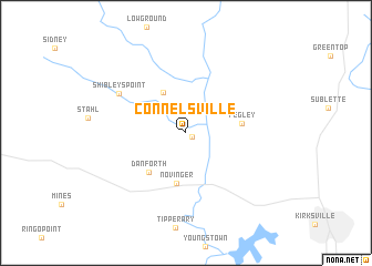
Connelsville (Missouri, United States - USA)Connelsville is a town in the Missouri region of United States - USA. An overview map of the region around Connelsville is displayed below.
regional and 3d topo map of Connelsville, United States - USA ::
Connelsville airports ::
The nearest airport is DSM - Des Moines Intl, located 161.4 km north west of Connelsville.
Other airports nearby include COU - Columbia Rgnl (167.2 km south), SZL - Knobnoster Whiteman Afb (186.6 km south west), Nearby towns ::
Nineveh (0.6km south east) //
Green Grove (4.4km north west) //
Novinger (5.1km south) //
Danforth (4.9km south west) //
Fegley (4.4km east) //
Shibleys Point (6.5km north west) //
[all distances 'as the bird flies' and approximate] 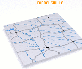 Places with similar names to Connelsville, United States - USA ::
// Connellsville (US)
Disclaimer :: Information on this page comes without warranty of any kind |
||
|
Where is Connelsville? Elevation and coordinates ::
Latitude (lat): 40°16'39"N Longitude (lon): 92°42'0"W
Elevation (approx.): 242m (map arrows pan, magnifying glasses zoom) |
||
|
Visiting Connelsville? Hotel/Accommodation ::
Book a hotel in Connelsville Travel Guide ::
rental cars ::
car rental offers GPS waypoint ::
download a GPX waypoint (PoI) of Connelsville for your GPS receiver
|
||