|
search place name
|
||
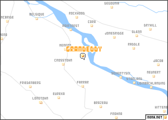
Grand Eddy (Missouri, United States - USA)Grand Eddy is a town in the Missouri region of United States - USA. An overview map of the region around Grand Eddy is displayed below.
regional and 3d topo map of Grand Eddy, United States - USA ::
Grand Eddy airports ::
The nearest airport is BLV - Belleville Scott Afb Midamerica, located 88.7 km north of Grand Eddy.
Other airports nearby include STL - St. Louis Lambert St Louis Intl (125.5 km north west), BYH - Blytheville Arkansas Intl (200.0 km south), JBR - Jonesboro Muni (230.0 km south), Nearby towns ::
Crosstown (3.8km west) //
Menfro (4.1km north west) //
Farrar (5.9km south) //
Point Rest (7.2km north) //
Cora (7.8km north) //
Jones Ridge (7.3km north east) //
Seventysix (7.6km south east) //
Eureka (9.6km south west) //
[all distances 'as the bird flies' and approximate] 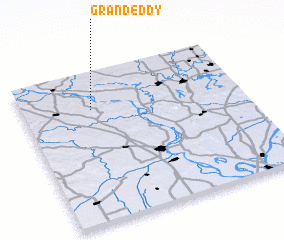 Places with similar names to Grand Eddy, United States - USA ::
// Korandadda (ET)
// Karandéti (TD)
// Granadita (CO)
// Karondoda (ID)
// Garin Dade (GH)
// Granadita (MX)
// Garin Dado (NE)
// Garin Toudou (NE)
// Garin Toudou (NE)
// Garin Toudou (NE)
Disclaimer :: Information on this page comes without warranty of any kind |
||
|
Where is Grand Eddy? Elevation and coordinates ::
Latitude (lat): 37°45'18"N Longitude (lon): 89°41'10"W
Elevation (approx.): 123m (map arrows pan, magnifying glasses zoom) |
||
|
Visiting Grand Eddy? Hotel/Accommodation ::
Book a hotel in Grand Eddy Travel Guide ::
rental cars ::
car rental offers GPS waypoint ::
download a GPX waypoint (PoI) of Grand Eddy for your GPS receiver
|
||