|
search place name
|
||
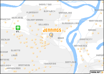
Jennings (Missouri, United States - USA)Jennings is a town in the Missouri region of United States - USA. An overview map of the region around Jennings is displayed below.
regional and 3d topo map of Jennings, United States - USA ::
Jennings airports ::
The nearest airport is STL - St. Louis Lambert St Louis Intl, located 10.1 km west of Jennings.
Other airports nearby include BLV - Belleville Scott Afb Midamerica (41.8 km south east), COU - Columbia Rgnl (170.6 km west), TBN - Fort Leonardwood Waynesville Rgnl Arpt At Forney Fld (197.2 km south west), Nearby towns ::
Flordell Hills (0.5km west) //
Country Club Hills (1.3km west) //
Goodfellow Terrace (2.6km south) //
Northwoods (2.6km south west) //
Pine Lawn (2.9km south west) //
Arbor Terrace (2.9km south west) //
Berdell Hills (2.7km west) //
Norwood Court (2.8km west) //
Baden (3.0km south east) //
Uplands Park (3.5km south west) //
Pasadena Hills (3.1km south west) //
Moline Acres (3.6km north east) //
Woodstock (3.1km north west) //
Normandy (3.2km west) //
Beverly Hills (3.5km south west) //
Pasadena Park (3.4km west) //
Velda Village Hills (3.9km south west) //
Dellwood (4.0km north west) //
Bellefontaine Neighbors (3.8km north east) //
Castle Point (4.5km north) //
Glen Echo Park (3.8km south west) //
Hillsdale (4.5km south west) //
Velda Village (4.4km south west) //
Prospect Hill (4.1km north east) //
Cool Valley (4.4km west) //
Ferguson (4.8km north west) //
Bellerive (4.7km west) //
Riverview (5.3km north east) //
Greendale (5.3km south west) //
[all distances 'as the bird flies' and approximate] 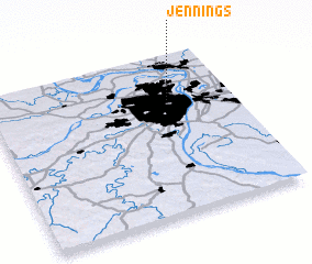 Places with similar names to Jennings, United States - USA ::
Disclaimer :: Information on this page comes without warranty of any kind |
||
|
Where is Jennings? Elevation and coordinates ::
Latitude (lat): 38°43'9"N Longitude (lon): 90°15'37"W
Elevation (approx.): 156m (map arrows pan, magnifying glasses zoom) |
||
|
Visiting Jennings? Hotel/Accommodation ::
Book a hotel in Jennings Travel Guide ::
rental cars ::
car rental offers GPS waypoint ::
download a GPX waypoint (PoI) of Jennings for your GPS receiver
|
||