|
search place name
|
||
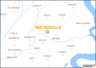
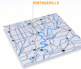
Portageville (Missouri, United States - USA)Portageville is a town in the Missouri region of United States - USA. An overview map of the region around Portageville is displayed below.
regional and 3d topo map of Portageville, United States - USA ::
Portageville airports ::
The nearest airport is BYH - Blytheville Arkansas Intl, located 55.7 km south west of Portageville.
Other airports nearby include JBR - Jonesboro Muni (107.7 km south west), MKL - Jackson Mc Kellar Sipes Rgnl (115.7 km south east), NQA - Millington Rgnl Jetport (119.6 km south), MEM - Memphis Intl (155.5 km south), Nearby towns ::
 Places with similar names to Portageville, United States - USA ::
// Partidgeville (US)
// Portageville (US)
Disclaimer :: Information on this page comes without warranty of any kind |
||
|
Where is Portageville? Elevation and coordinates ::
Latitude (lat): 36°25'31"N Longitude (lon): 89°41'58"W
Elevation (approx.): 85m (map arrows pan, magnifying glasses zoom) |
||
|
Visiting Portageville? Hotel/Accommodation ::
Book a hotel in Portageville Travel Guide ::
rental cars ::
car rental offers GPS waypoint ::
download a GPX waypoint (PoI) of Portageville for your GPS receiver
|
||