|
search place name
|
||
Conkelley (Montana, United States - USA)Conkelley is a town in the Montana region of United States - USA. An overview map of the region around Conkelley is displayed below.
regional and 3d topo map of Conkelley, United States - USA ::

Conkelley airports ::
The nearest airport is CTB - Cutbank Cut Bank Muni, located 132.0 km east of Conkelley.
Other airports nearby include YQL - Lethbridge (168.9 km north east), YXC - Cranbrook (181.7 km north west), YZS - Coral Harbour Fairmont Hot Springs (250.2 km north west), Nearby towns ::
Columbia Falls (4.1km south west) //
Pine Park (4.4km south west) //
Country Estates Mobile Home Park (4.4km west) //
Big Sky Colonial Manor (5.6km south west) //
Hungry Horse (5.3km east) //
Stipes Trailer Court (5.3km east) //
Lazy Day Court (6.2km west) //
[all distances 'as the bird flies' and approximate] 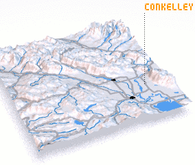 Places with similar names to Conkelley, United States - USA ::
Disclaimer :: Information on this page comes without warranty of any kind |
||
|
Where is Conkelley? Elevation and coordinates ::
Latitude (lat): 48°23'22"N Longitude (lon): 114°7'55"W
Elevation (approx.): 947m (map arrows pan, magnifying glasses zoom) |
||
|
Visiting Conkelley? Hotel/Accommodation ::
Book a hotel in Conkelley Travel Guide ::
rental cars ::
car rental offers GPS waypoint ::
download a GPX waypoint (PoI) of Conkelley for your GPS receiver
|
||