|
search place name
|
||
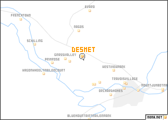
De Smet (Montana, United States - USA)De Smet is a town in the Montana region of United States - USA. An overview map of the region around De Smet is displayed below.
regional and 3d topo map of De Smet, United States - USA ::
De Smet airports ::
The nearest airport is CTB - Cutbank Cut Bank Muni, located 226.8 km north east of De Smet.
Nearby towns ::
Wye (2.6km north west) //
Skyline Trailer Court (2.2km west) //
Grass Valley (2.8km west) //
Green Field Mobile Home Park (5.7km south) //
Old Hellgate Village Trailer Park (5.7km south) //
Countryside Court Mobile Home Park (5.6km south east) //
Nagos (6.5km north) //
Primrose (4.9km west) //
Westview Park (5.2km south east) //
Orchard Homes (8.8km south east) //
[all distances 'as the bird flies' and approximate]  Places with similar names to De Smet, United States - USA ::
Disclaimer :: Information on this page comes without warranty of any kind |
||
|
Where is De Smet? Elevation and coordinates ::
Latitude (lat): 46°56'0"N Longitude (lon): 114°6'8"W
Elevation (approx.): 983m (map arrows pan, magnifying glasses zoom) |
||
|
Visiting De Smet? Hotel/Accommodation ::
Book a hotel in De Smet Travel Guide ::
rental cars ::
car rental offers GPS waypoint ::
download a GPX waypoint (PoI) of De Smet for your GPS receiver
|
||