|
search place name
|
||
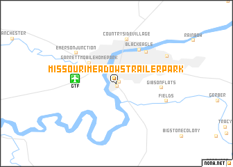
Missouri Meadows Trailer Park (Montana, United States - USA)Missouri Meadows Trailer Park is a town in the Montana region of United States - USA. An overview map of the region around Missouri Meadows Trailer Park is displayed below.
regional and 3d topo map of Missouri Meadows Trailer Park, United States - USA ::
Missouri Meadows Trailer Park airports ::
The nearest airport is GTF - Great Falls Intl, located 4.5 km west of Missouri Meadows Trailer Park.
Other airports nearby include HLN - Helena Rgnl (109.3 km south west), CTB - Cutbank Cut Bank Muni (148.8 km north west), Nearby towns ::
Rivershore Mobile Home Park (0.4km south) //
Pleasant Park Mobile Home Court (0.4km north east) //
Great Falls (2.8km north) //
Garrett Mobile Home Park (4.4km north west) //
Black Eagle (6.0km north east) //
Smelter Hill (6.0km north east) //
Countryside Village (7.1km north) //
Gibson Flats (4.9km east) //
Emerson Junction (6.5km north west) //
Fields (6.1km south east) //
Highwoods Mobile Home Park (7.0km north east) //
[all distances 'as the bird flies' and approximate] 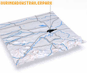 Places with similar names to Missouri Meadows Trailer Park, United States - USA :: Disclaimer :: Information on this page comes without warranty of any kind |
||
|
Where is Missouri Meadows Trailer Park? Elevation and coordinates ::
Latitude (lat): 47°28'34"N Longitude (lon): 111°18'40"W
Elevation (approx.): 1014m (map arrows pan, magnifying glasses zoom) |
||
|
Visiting Missouri Meadows Trailer Park? Hotel/Accommodation ::
Book a hotel in Missouri Meadows Trailer Park Travel Guide ::
rental cars ::
car rental offers GPS waypoint ::
download a GPX waypoint (PoI) of Missouri Meadows Trailer Park for your GPS receiver
|
||