|
search place name
|
||
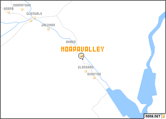
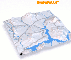
Moapa Valley (Nevada, United States - USA)Moapa Valley is a town in the Nevada region of United States - USA. An overview map of the region around Moapa Valley is displayed below.
regional and 3d topo map of Moapa Valley, United States - USA ::
Moapa Valley airports ::
The nearest airport is LSV - Las Vegas Nellis Afb, located 63.5 km south west of Moapa Valley.
Other airports nearby include LAS - Las Vegas Mc Carran Intl (82.7 km south west), CDC - Cedar City Rgnl (174.0 km north east), Nearby towns ::
 Places with similar names to Moapa Valley, United States - USA ::
Disclaimer :: Information on this page comes without warranty of any kind |
||
|
Where is Moapa Valley? Elevation and coordinates ::
Latitude (lat): 36°34'50"N Longitude (lon): 114°28'10"W
Elevation (approx.): 410m (map arrows pan, magnifying glasses zoom) |
||
|
Visiting Moapa Valley? Hotel/Accommodation ::
Book a hotel in Moapa Valley Travel Guide ::
rental cars ::
car rental offers GPS waypoint ::
download a GPX waypoint (PoI) of Moapa Valley for your GPS receiver
|
||