|
search place name
|
||
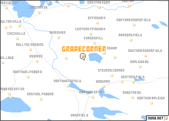
Grape Corner (New Hampshire, United States - USA)Grape Corner is a town in the New Hampshire region of United States - USA. An overview map of the region around Grape Corner is displayed below.
regional and 3d topo map of Grape Corner, United States - USA ::
Grape Corner airports ::
The nearest airport is PWM - Portland Intl Jetport, located 57.7 km east of Grape Corner.
Other airports nearby include BED - Bedford Laurence G Hanscom Fld (136.9 km south), BOS - Boston General Edward Lawrence Logan Intl (146.9 km south), YSC - Sherbrooke (201.8 km north), CEF - Chicopee Falls Westover Arb Metropolitan (206.7 km south west), Nearby towns ::
Granite (3.0km west) //
Chases Mill (4.1km north) //
South Effingham (3.5km north east) //
South Effingham (3.6km north east) //
Center Effingham (6.0km north) //
North Wakefield (6.2km south west) //
Roberts Corner (4.9km east) //
Stevens Corner (5.5km south east) //
Woodman (6.6km south east) //
Pine River (6.5km north west) //
East Wakefield (8.2km south) //
Effingham (8.5km north) //
Mee Corners (7.7km south east) //
[all distances 'as the bird flies' and approximate] 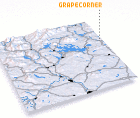 Places with similar names to Grape Corner, United States - USA :: Disclaimer :: Information on this page comes without warranty of any kind |
||
|
Where is Grape Corner? Elevation and coordinates ::
Latitude (lat): 43°41'12"N Longitude (lon): 71°1'20"W
Elevation (approx.): 240m (map arrows pan, magnifying glasses zoom) |
||
|
Visiting Grape Corner? Hotel/Accommodation ::
Book a hotel in Grape Corner Travel Guide ::
rental cars ::
car rental offers GPS waypoint ::
download a GPX waypoint (PoI) of Grape Corner for your GPS receiver
|
||