|
search place name
|
||
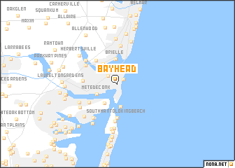
Bay Head (New Jersey, United States - USA)Bay Head is a town in the New Jersey region of United States - USA. An overview map of the region around Bay Head is displayed below.
regional and 3d topo map of Bay Head, United States - USA ::
Bay Head airports ::
The nearest airport is NEL - Lakehurst Naes, located 25.8 km west of Bay Head.
Other airports nearby include WRI - Wrightstown Mc Guire Afb (46.2 km west), JFK - New York John F Kennedy Intl (67.3 km north), TTN - Trenton Mercer (68.5 km west), EWR - Newark Liberty Intl (69.6 km north), Nearby towns ::
Bay Head Junction (1.0km north east) //
Point Pleasant (1.7km north west) //
Clarks Landing (2.2km north) //
Point Pleasant Beach (2.2km north) //
Metedeconk (3.0km south west) //
Mantoloking (3.6km south) //
West Mantoloking (3.5km south west) //
Manasquan Park (3.6km north west) //
Brielle (4.0km north) //
Sterling Woods (4.6km north west) //
Adamston (4.5km south west) //
South Mantoloking Beach (5.4km south) //
Arrowhead Village (4.2km west) //
Riviera Beach (4.9km north west) //
Mantoloking Shores (6.0km south) //
Manasquan (6.1km north) //
Winding River Village (5.4km north west) //
Baywood (6.2km south west) //
Breton Woods (5.5km south west) //
Osbornsville (5.9km south west) //
Sea Girt (6.9km north) //
Camp Osborne (7.1km south) //
Blansingburg (7.2km north) //
Mantoloking Estates (7.2km south) //
Shore Acres (6.5km south west) //
Mandalay (7.0km south west) //
Herbertsville (6.5km north west) //
Normandy Beach (7.7km south) //
Villa Park (8.1km north) //
[all distances 'as the bird flies' and approximate] 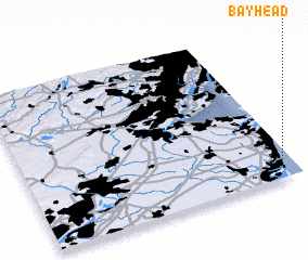 Places with similar names to Bay Head, United States - USA ::
Disclaimer :: Information on this page comes without warranty of any kind |
||
|
Where is Bay Head? Elevation and coordinates ::
Latitude (lat): 40°4'18"N Longitude (lon): 74°3'17"W
Elevation (approx.): 4m (map arrows pan, magnifying glasses zoom) |
||
|
Visiting Bay Head? Hotel/Accommodation ::
Book a hotel in Bay Head Travel Guide ::
rental cars ::
car rental offers GPS waypoint ::
download a GPX waypoint (PoI) of Bay Head for your GPS receiver
|
||