|
search place name
|
||
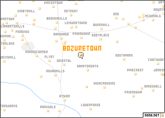
Bozuretown (New Jersey, United States - USA)Bozuretown is a town in the New Jersey region of United States - USA. An overview map of the region around Bozuretown is displayed below.
regional and 3d topo map of Bozuretown, United States - USA ::
Bozuretown airports ::
The nearest airport is WRI - Wrightstown Mc Guire Afb, located 22.6 km north of Bozuretown.
Other airports nearby include NEL - Lakehurst Naes (36.8 km north east), ACY - Atlantic City Intl (42.1 km south), PHL - Philadelphia Intl (47.5 km west), TTN - Trenton Mercer (51.1 km north), Nearby towns ::
Hampton Gate (2.7km south) //
Tabernacle (2.6km north west) //
Oriental (3.5km west) //
Friendship (4.9km north) //
Fox Chase (4.6km north west) //
Moores Mill (4.9km north west) //
Sooy Place (5.5km north east) //
Hampton Furnace (6.4km south) //
Oak Shade (6.0km north west) //
Indian Mills (6.0km south west) //
Meadford Farms (6.1km north west) //
Leisuretowne (7.4km north) //
Flyat (5.8km west) //
Hampton Lakes (7.5km north) //
High Crossing (7.5km south east) //
Burrs Mill (7.6km north east) //
Johnson Place (7.3km north east) //
Red Lion (8.4km north west) //
Beaverville (9.5km north west) //
[all distances 'as the bird flies' and approximate]  Places with similar names to Bozuretown, United States - USA ::
Disclaimer :: Information on this page comes without warranty of any kind |
||
|
Where is Bozuretown? Elevation and coordinates ::
Latitude (lat): 39°49'36"N Longitude (lon): 74°41'22"W
Elevation (approx.): 30m (map arrows pan, magnifying glasses zoom) |
||
|
Visiting Bozuretown? Hotel/Accommodation ::
Book a hotel in Bozuretown Travel Guide ::
rental cars ::
car rental offers GPS waypoint ::
download a GPX waypoint (PoI) of Bozuretown for your GPS receiver
|
||