|
search place name
|
||
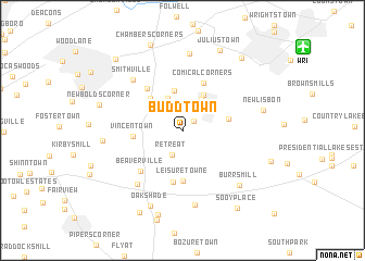
Buddtown (New Jersey, United States - USA)Buddtown is a town in the New Jersey region of United States - USA. An overview map of the region around Buddtown is displayed below.
regional and 3d topo map of Buddtown, United States - USA ::
Buddtown airports ::
The nearest airport is WRI - Wrightstown Mc Guire Afb, located 12.8 km north east of Buddtown.
Other airports nearby include NEL - Lakehurst Naes (31.7 km east), TTN - Trenton Mercer (38.6 km north), PHL - Philadelphia Intl (46.6 km west), NXX - Willow Grove Nas Jrb (47.7 km north west), Nearby towns ::
Scrapetown (1.3km north east) //
Retreat (2.7km south) //
Crescent Heights (3.5km north) //
Pemberton Heights (3.3km north east) //
South Pemberton (3.5km north east) //
Birmingham (4.1km north) //
Pemberton (4.0km north east) //
Scratch Ridge (4.2km north west) //
Magnolia (3.8km east) //
Vincentown (3.9km west) //
Leisuretowne (5.2km south) //
Hampton Lakes (5.3km south) //
Comical Corners (5.2km north) //
Ewansville (5.1km north west) //
Beaverville (5.3km south west) //
Red Lion (6.6km south west) //
Smithville (6.5km north west) //
Friendship (7.7km south) //
Arneys Mount (7.9km north) //
Burrs Mill (7.2km south east) //
Lippincotts Corner (6.4km west) //
Oak Shade (8.2km south) //
New Lisbon (6.7km east) //
Newbolds Corner (7.1km west) //
Moores Mill (8.9km south) //
Juliustown (8.7km north) //
Chambers Corners (9.1km north) //
Meadford Farms (9.1km south) //
Lewistown (8.8km north east) //
[all distances 'as the bird flies' and approximate] 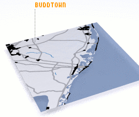 Places with similar names to Buddtown, United States - USA ::
Disclaimer :: Information on this page comes without warranty of any kind |
||
|
Where is Buddtown? Elevation and coordinates ::
Latitude (lat): 39°56'21"N Longitude (lon): 74°42'12"W
Elevation (approx.): 19m (map arrows pan, magnifying glasses zoom) |
||
|
Visiting Buddtown? Hotel/Accommodation ::
Book a hotel in Buddtown Travel Guide ::
rental cars ::
car rental offers GPS waypoint ::
download a GPX waypoint (PoI) of Buddtown for your GPS receiver
|
||