|
search place name
|
||
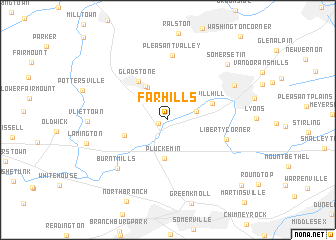
Far Hills (New Jersey, United States - USA)Far Hills is a town in the New Jersey region of United States - USA. An overview map of the region around Far Hills is displayed below.
regional and 3d topo map of Far Hills, United States - USA ::
Far Hills airports ::
The nearest airport is EWR - Newark Liberty Intl, located 39.5 km east of Far Hills.
Other airports nearby include TTN - Trenton Mercer (47.7 km south), TEB - Teterboro (51.9 km east), LGA - New York La Guardia (65.3 km east), NXX - Willow Grove Nas Jrb (69.1 km south west), Nearby towns ::
Bedminster (0.9km south west) //
Mine Brook (2.6km east) //
Peapack (4.0km north west) //
Pluckemin (4.3km south) //
Peapack and Gladstone (4.2km north west) //
Greater Cross Roads (4.1km south west) //
Pill Hill (4.2km north east) //
Gladstone (4.9km north west) //
Liberty Corner (5.4km south east) //
Pleasant Valley (7.2km north) //
Burnt Mills (6.9km south west) //
Bernardsville (6.8km north east) //
Somersetin (8.0km north east) //
Mount Horeb (9.6km south east) //
[all distances 'as the bird flies' and approximate]  Places with similar names to Far Hills, United States - USA ::
// Vorholz (AT)
// Frahels (DE)
// Freihöls (DE)
// Freihöls (DE)
// Fürholz (DE)
// Vahrholz (DE)
// Vorholz (DE)
// Vorholz (DE)
// Fair Hills (US)
// Four Holes (US)
Disclaimer :: Information on this page comes without warranty of any kind |
||
|
Where is Far Hills? Elevation and coordinates ::
Latitude (lat): 40°41'3"N Longitude (lon): 74°38'10"W
Elevation (approx.): 46m (map arrows pan, magnifying glasses zoom) |
||
|
Visiting Far Hills? Hotel/Accommodation ::
Book a hotel in Far Hills Travel Guide ::
rental cars ::
car rental offers GPS waypoint ::
download a GPX waypoint (PoI) of Far Hills for your GPS receiver
|
||