|
search place name
|
||
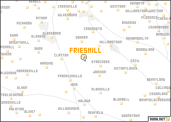
Fries Mill (New Jersey, United States - USA)Fries Mill is a town in the New Jersey region of United States - USA. An overview map of the region around Fries Mill is displayed below.
regional and 3d topo map of Fries Mill, United States - USA ::
Fries Mill airports ::
The nearest airport is PHL - Philadelphia Intl, located 29.2 km north west of Fries Mill.
Other airports nearby include MIV - Millville Muni (32.1 km south), ACY - Atlantic City Intl (45.9 km south east), ILG - Wilmington New Castle (48.2 km west), WRI - Wrightstown Mc Guire Afb (55.7 km north east), Nearby towns ::
Star Cross (2.8km south east) //
Downer (4.3km north) //
Robanna (4.0km north east) //
Janvier (4.0km south east) //
Clayton (4.0km west) //
Franklinville (5.0km south west) //
Williamstown (5.4km north east) //
Iona (6.4km south) //
Cross Keys (6.5km north) //
Plainville (7.5km south) //
Porchtown (7.6km south west) //
Harding (6.7km west) //
Glassboro (7.7km north west) //
Victory Lakes (7.2km east) //
Sicklerville (9.4km north east) //
[all distances 'as the bird flies' and approximate]  Places with similar names to Fries Mill, United States - USA ::
Disclaimer :: Information on this page comes without warranty of any kind |
||
|
Where is Fries Mill? Elevation and coordinates ::
Latitude (lat): 39°39'22"N Longitude (lon): 75°2'44"W
Elevation (approx.): 41m (map arrows pan, magnifying glasses zoom) |
||
|
Visiting Fries Mill? Hotel/Accommodation ::
Book a hotel in Fries Mill Travel Guide ::
rental cars ::
car rental offers GPS waypoint ::
download a GPX waypoint (PoI) of Fries Mill for your GPS receiver
|
||