|
search place name
|
||
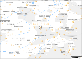
Glenfield (New Jersey, United States - USA)Glenfield is a town in the New Jersey region of United States - USA. An overview map of the region around Glenfield is displayed below.
regional and 3d topo map of Glenfield, United States - USA ::
Glenfield airports ::
The nearest airport is EWR - Newark Liberty Intl, located 20.8 km east of Glenfield.
Other airports nearby include TEB - Teterboro (31.4 km east), LGA - New York La Guardia (45.2 km east), JFK - New York John F Kennedy Intl (54.2 km east), TTN - Trenton Mercer (62.3 km south west), Nearby towns ::
Crestview (0.3km north west) //
Floral Hill (1.5km south) //
Knollwood (1.9km north) //
Madison (2.1km north west) //
Chatham (1.8km east) //
Ridgedale Park (2.7km north) //
Rosedale Village (2.9km north) //
Hickory Tree (2.3km west) //
Yardley Village (3.0km north) //
Madison Heights (2.5km north west) //
Afton (3.5km north) //
Oakwood Park (3.7km south) //
Fairwoods (3.5km north west) //
Shady Lawn Manor (4.1km north west) //
Long Hill (4.4km south west) //
New Providence (5.0km south) //
Loantaka Estates (4.4km north west) //
Summit (3.8km east) //
Florham Park (5.2km north) //
Murray Hill (5.3km south) //
Woodland Park (5.0km south east) //
Green Village (4.1km west) //
Overlook (5.7km south east) //
Benders Corner (7.0km south) //
Tremont Park (6.1km south east) //
Brantwood (5.7km east) //
Homestead Park (7.0km south west) //
Berkeley Heights (7.4km south west) //
White Oak Ridge (6.0km east) //
[all distances 'as the bird flies' and approximate] 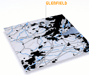 Places with similar names to Glenfield, United States - USA ::
// Kleinfeld (AT)
// Kleinfeld (DE)
// Klein Felda (DE)
// Klein Flotow (DE)
// Kolenfeld (DE)
// Kuhlenfeld (DE)
// Kelenföld (HU)
// Glenfield (ZA)
// Glenfield (NZ)
// Glenfield (US)
Disclaimer :: Information on this page comes without warranty of any kind |
||
|
Where is Glenfield? Elevation and coordinates ::
Latitude (lat): 40°44'35"N Longitude (lon): 74°24'20"W
Elevation (approx.): 120m (map arrows pan, magnifying glasses zoom) |
||
|
Visiting Glenfield? Hotel/Accommodation ::
Book a hotel in Glenfield Travel Guide ::
rental cars ::
car rental offers GPS waypoint ::
download a GPX waypoint (PoI) of Glenfield for your GPS receiver
|
||