|
search place name
|
||
Hughesville (New Jersey, United States - USA)Hughesville is a town in the New Jersey region of United States - USA. An overview map of the region around Hughesville is displayed below.
regional and 3d topo map of Hughesville, United States - USA ::

Hughesville airports ::
The nearest airport is NXX - Willow Grove Nas Jrb, located 46.9 km south of Hughesville.
Other airports nearby include TTN - Trenton Mercer (48.1 km south east), WRI - Wrightstown Mc Guire Afb (82.7 km south east), PHL - Philadelphia Intl (83.6 km south), EWR - Newark Liberty Intl (83.9 km east), Nearby towns ::
Finesville (2.0km south west) //
Warren Glen (2.1km north east) //
Springtown (3.0km north) //
Amsterdam (3.8km south) //
Carpentersville (3.2km north west) //
Riegel Ridge (3.3km south east) //
Kennedys (3.8km north east) //
Raubsville (3.5km north west) //
Riegelsville (4.0km south west) //
Alpha (5.0km north) //
Mount Joy (4.7km south west) //
Spring Mills (4.5km south east) //
Riegelsville (4.6km south west) //
Holland (5.6km south) //
Coffeetown (4.4km west) //
Still Valley (6.0km north) //
Kennedy Mills (5.6km north east) //
Narrowsville (6.2km south) //
Durham Furnace (5.9km south west) //
Monroe (6.3km south west) //
Yocum Estates (7.0km south) //
Golden Acres Estates (7.2km south east) //
Kintnersville (7.5km south) //
Ruppletown (7.6km south east) //
Port Warren (8.2km north) //
Bloomsbury (6.8km north east) //
Phillipsburg (8.5km north) //
Upper Black Eddy (7.9km south east) //
Little York (6.8km east) //
[all distances 'as the bird flies' and approximate] 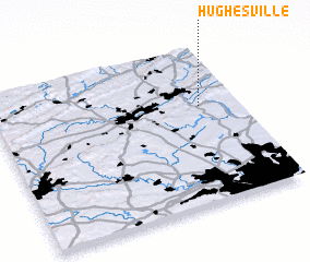 Places with similar names to Hughesville, United States - USA ::
// Hughesville (US)
// Hughesville (US)
// Hughesville (US)
// Haafsville (US)
// Hughesville (US)
// Hughesville (US)
// Hivesville (AU)
Disclaimer :: Information on this page comes without warranty of any kind |
||
|
Where is Hughesville? Elevation and coordinates ::
Latitude (lat): 40°37'19"N Longitude (lon): 75°9'22"W
Elevation (approx.): 81m (map arrows pan, magnifying glasses zoom) |
||
|
Visiting Hughesville? Hotel/Accommodation ::
Book a hotel in Hughesville Travel Guide ::
rental cars ::
car rental offers GPS waypoint ::
download a GPX waypoint (PoI) of Hughesville for your GPS receiver
|
||