|
search place name
|
||
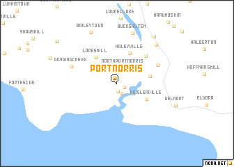
Port Norris (New Jersey, United States - USA)Port Norris is a town in the New Jersey region of United States - USA. An overview map of the region around Port Norris is displayed below.
regional and 3d topo map of Port Norris, United States - USA ::
Port Norris airports ::
The nearest airport is MIV - Millville Muni, located 13.9 km north of Port Norris.
Other airports nearby include WWD - Wildwood Cape May Co (28.6 km south east), DOV - Dover Afb (39.4 km west), ACY - Atlantic City Intl (46.0 km north east), ILG - Wilmington New Castle (68.7 km north west), Nearby towns ::
Bivalve (1.3km south) //
Shell Pile (1.1km south east) //
Maurice River (1.7km south) //
North Port Norris (2.6km north) //
New Italy (2.7km north west) //
Dragston (3.9km north west) //
Haleyville (5.1km north) //
Heislerville (4.5km south east) //
Lores Mill (5.0km north west) //
Leesburg (4.3km east) //
Mauricetown (5.7km north east) //
Dorchester (5.8km north east) //
Dividing Creek (6.3km north west) //
Buckshutem (8.4km north) //
Bricksboro (7.9km north east) //
Baileytown (8.8km north) //
Port Elizabeth (8.8km north east) //
[all distances 'as the bird flies' and approximate] 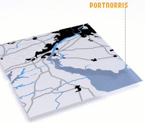 Places with similar names to Port Norris, United States - USA :: Disclaimer :: Information on this page comes without warranty of any kind |
||
|
Where is Port Norris? Elevation and coordinates ::
Latitude (lat): 39°14'45"N Longitude (lon): 75°2'8"W
Elevation (approx.): 6m (map arrows pan, magnifying glasses zoom) |
||
|
Visiting Port Norris? Hotel/Accommodation ::
Book a hotel in Port Norris Travel Guide ::
rental cars ::
car rental offers GPS waypoint ::
download a GPX waypoint (PoI) of Port Norris for your GPS receiver
|
||