|
search place name
|
||
Wayside (New Jersey, United States - USA)Wayside is a town in the New Jersey region of United States - USA. An overview map of the region around Wayside is displayed below.
regional and 3d topo map of Wayside, United States - USA ::

Wayside airports ::
The nearest airport is NEL - Lakehurst Naes, located 34.3 km south west of Wayside.
Other airports nearby include EWR - Newark Liberty Intl (49.0 km north), JFK - New York John F Kennedy Intl (49.4 km north east), WRI - Wrightstown Mc Guire Afb (51.5 km south west), LGA - New York La Guardia (60.3 km north), Nearby towns ::
Cold Indian Springs (1.8km south east) //
Wileys Corners (1.5km west) //
Green Grove (2.5km south) //
Pine Brook (3.2km north west) //
Dogs Corners (2.9km east) //
Reevytown (3.1km south west) //
Wertheins Corner (3.0km east) //
Macedonia (3.8km north west) //
Eatontown (4.8km north east) //
West Deal (4.2km south east) //
Hamilton (5.6km south) //
Cooks Mills (4.9km north west) //
Whitesville (5.2km south east) //
Tinton Falls (5.7km north west) //
Wanamassa (5.0km south east) //
Remsen Mill (6.5km south) //
West Grove (6.0km south east) //
Oakhurst (5.2km east) //
West Shrewsbury (6.6km north) //
Oakhurst Manor (5.3km east) //
Interlaken (5.6km south east) //
West Allenhurst (5.7km east) //
Glendola (7.3km south) //
Deal Park (5.6km east) //
West Long Branch (6.1km north east) //
Shark River Hills (7.3km south) //
Collingwood Park (6.3km south west) //
Elberon Park (5.8km east) //
Bradley Park (7.2km south east) //
[all distances 'as the bird flies' and approximate] 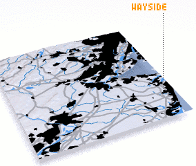 Places with similar names to Wayside, United States - USA ::
Disclaimer :: Information on this page comes without warranty of any kind |
||
|
Where is Wayside? Elevation and coordinates ::
Latitude (lat): 40°15'24"N Longitude (lon): 74°4'30"W
Elevation (approx.): 43m (map arrows pan, magnifying glasses zoom) |
||
|
Visiting Wayside? Hotel/Accommodation ::
Book a hotel in Wayside Travel Guide ::
rental cars ::
car rental offers GPS waypoint ::
download a GPX waypoint (PoI) of Wayside for your GPS receiver
|
||