|
search place name
|
||
Weekstown (New Jersey, United States - USA)Weekstown is a town in the New Jersey region of United States - USA. An overview map of the region around Weekstown is displayed below.
regional and 3d topo map of Weekstown, United States - USA ::

Weekstown airports ::
The nearest airport is ACY - Atlantic City Intl, located 15.1 km south of Weekstown.
Other airports nearby include WRI - Wrightstown Mc Guire Afb (47.0 km north), MIV - Millville Muni (47.4 km south west), NEL - Lakehurst Naes (53.5 km north east), PHL - Philadelphia Intl (62.9 km north west), Nearby towns ::
Green Bank (2.6km north east) //
Herman (2.9km north) //
Glouster Landing (3.2km east) //
Crowleytown (4.2km north) //
Bulltown (5.2km north) //
Gardiners Landing (4.9km north west) //
Lower Bank (4.9km east) //
Sweetwater (5.5km north west) //
Tylertown (7.0km north) //
Clarks Landing (5.8km east) //
Batsto (6.7km north west) //
Pleasant Mills (7.3km north west) //
Egg Harbor City (8.0km south west) //
Devonshire (7.8km south west) //
South Egg Harbor (8.9km south west) //
Maxwell (9.9km north east) //
West Egg Harbor (10.0km south west) //
[all distances 'as the bird flies' and approximate] 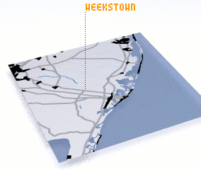 Places with similar names to Weekstown, United States - USA ::
// Wixtown (US)
// Wacays Oodane (SO)
Disclaimer :: Information on this page comes without warranty of any kind |
||
|
Where is Weekstown? Elevation and coordinates ::
Latitude (lat): 39°35'31"N Longitude (lon): 74°36'12"W
Elevation (approx.): 10m (map arrows pan, magnifying glasses zoom) |
||
|
Visiting Weekstown? Hotel/Accommodation ::
Book a hotel in Weekstown Travel Guide ::
rental cars ::
car rental offers GPS waypoint ::
download a GPX waypoint (PoI) of Weekstown for your GPS receiver
|
||