|
search place name
|
||
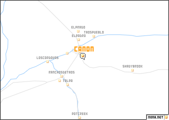
Canon (New Mexico, United States - USA)Canon is a town in the New Mexico region of United States - USA. An overview map of the region around Canon is displayed below.
regional and 3d topo map of Canon, United States - USA ::
Canon airports ::
The nearest airport is ABQ - Albuquerque Intl Sunport (Kirtland Afb), located 177.3 km south west of Canon.
Other airports nearby include TCC - Tucumcari Muni (222.1 km south east), PUB - Pueblo Memorial Pueblo Mem (230.9 km north east), Nearby towns ::
Taos (2.0km north west) //
Ranchito (3.4km north west) //
El Padro (4.7km north) //
Taos Pueblo (5.6km north) //
Ranchos de Taos (5.5km south west) //
El Prado (6.5km north) //
Talpa (6.3km south west) //
Llano Quemado (6.4km south west) //
Los Cordovas (6.7km west) //
[all distances 'as the bird flies' and approximate] 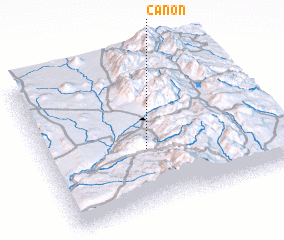 Places with similar names to Canon, United States - USA ::
Disclaimer :: Information on this page comes without warranty of any kind |
||
|
Where is Canon? Elevation and coordinates ::
Latitude (lat): 36°23'27"N Longitude (lon): 105°33'46"W
Elevation (approx.): 2134m (map arrows pan, magnifying glasses zoom) |
||
|
Visiting Canon? Hotel/Accommodation ::
Book a hotel in Canon Travel Guide ::
rental cars ::
car rental offers GPS waypoint ::
download a GPX waypoint (PoI) of Canon for your GPS receiver
|
||