|
search place name
|
||
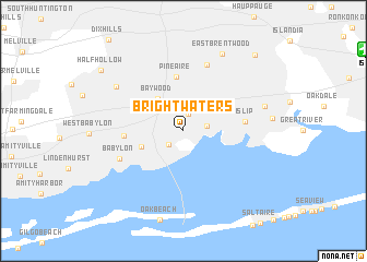
Brightwaters (New York, United States - USA)Brightwaters is a town in the New York region of United States - USA. An overview map of the region around Brightwaters is displayed below.
regional and 3d topo map of Brightwaters, United States - USA ::
Brightwaters airports ::
The nearest airport is ISP - Islip Long Island Mac Arthur, located 16.4 km north east of Brightwaters.
Other airports nearby include JFK - New York John F Kennedy Intl (44.1 km west), BDR - Stratford Igor I Sikorsky Mem (50.6 km north), LGA - New York La Guardia (51.5 km west), HPN - White Plains Westchester Co (53.4 km north west), Nearby towns ::
North Bay Shore (1.7km north) //
West Bay Shore (1.8km south west) //
Bay Shore (1.9km east) //
Bay Wood (3.8km north west) //
West Islip (3.7km south west) //
Pine Aire (5.6km north) //
North Babylon (4.6km west) //
Islip (4.9km east) //
Babylon (5.7km south west) //
Brentwood (6.9km north) //
Deer Park (6.9km north west) //
Islip Terrace (6.8km east) //
East Brentwood (8.5km north) //
Half Hollow (8.9km north west) //
Central Islip (9.5km north east) //
[all distances 'as the bird flies' and approximate] 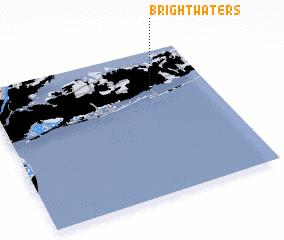 Places with similar names to Brightwaters, United States - USA :: Disclaimer :: Information on this page comes without warranty of any kind |
||
|
Where is Brightwaters? Elevation and coordinates ::
Latitude (lat): 40°43'15"N Longitude (lon): 73°16'4"W
Elevation (approx.): 10m (map arrows pan, magnifying glasses zoom) |
||
|
Visiting Brightwaters? Hotel/Accommodation ::
Book a hotel in Brightwaters Travel Guide ::
rental cars ::
car rental offers GPS waypoint ::
download a GPX waypoint (PoI) of Brightwaters for your GPS receiver
|
||