|
search place name
|
||
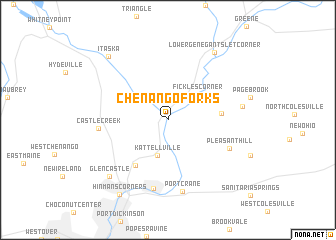
Chenango Forks (New York, United States - USA)Chenango Forks is a town in the New York region of United States - USA. An overview map of the region around Chenango Forks is displayed below.
regional and 3d topo map of Chenango Forks, United States - USA ::
Chenango Forks airports ::
The nearest airport is SYR - Syracuse Hancock Intl, located 99.5 km north of Chenango Forks.
Other airports nearby include IPT - Williamsport Rgnl (141.9 km south west), SWF - Newburgh Stewart Intl (166.0 km south east), ROC - Greater Rochester Intl (178.8 km north west), ART - Watertown Intl (195.6 km north), Nearby towns ::
Kattellville (4.1km south) //
Fickles Corner (3.8km north east) //
North Fenton (4.5km east) //
Newmans Corner (5.7km south west) //
Pleasant Hill (6.0km south east) //
Chenango Bridge (7.7km south) //
Castle Creek (5.8km west) //
Port Crane (8.0km south) //
Quinneville (6.3km east) //
Glen Castle (7.9km south west) //
Lower Genegantslet Corner (8.5km north east) //
Itaska (8.6km north west) //
Hinmans Corners (9.3km south west) //
[all distances 'as the bird flies' and approximate] 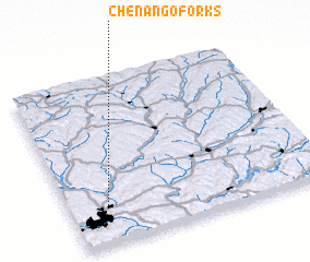 Places with similar names to Chenango Forks, United States - USA :: Disclaimer :: Information on this page comes without warranty of any kind |
||
|
Where is Chenango Forks? Elevation and coordinates ::
Latitude (lat): 42°14'8"N Longitude (lon): 75°50'55"W
Elevation (approx.): 295m (map arrows pan, magnifying glasses zoom) |
||
|
Visiting Chenango Forks? Hotel/Accommodation ::
Book a hotel in Chenango Forks Travel Guide ::
rental cars ::
car rental offers GPS waypoint ::
download a GPX waypoint (PoI) of Chenango Forks for your GPS receiver
|
||