|
search place name
|
||
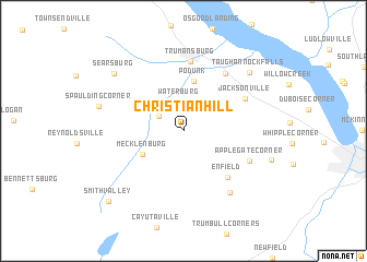
Christian Hill (New York, United States - USA)Christian Hill is a town in the New York region of United States - USA. An overview map of the region around Christian Hill is displayed below.
regional and 3d topo map of Christian Hill, United States - USA ::
Christian Hill airports ::
The nearest airport is SYR - Syracuse Hancock Intl, located 84.2 km north east of Christian Hill.
Other airports nearby include ROC - Greater Rochester Intl (108.4 km north west), IPT - Williamsport Rgnl (138.9 km south), ART - Watertown Intl (176.2 km north), GTB - Fort Drum Wheeler Sack Aaf (191.5 km north east), Nearby towns ::
Perry City (2.4km north west) //
Waterburg (3.0km north) //
Mecklenburg (3.9km south west) //
Podunk (5.1km north) //
Enfield (5.8km south east) //
Trumansburg (7.1km north) //
Jacksonville (5.7km north east) //
Halseyville (6.7km north east) //
Applegate Corner (5.8km south east) //
Bostwick Corners (7.3km south east) //
Taughannock Falls (7.7km north east) //
Spaulding Corner (6.9km west) //
Searsburg (7.8km north west) //
Smith Valley (9.2km south west) //
[all distances 'as the bird flies' and approximate] 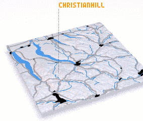 Places with similar names to Christian Hill, United States - USA ::
// Christian Hollow (US)
// Christian Hill (US)
// Christian Hill (US)
// Christian Hill (US)
// Christian Hill (AG)
Disclaimer :: Information on this page comes without warranty of any kind |
||
|
Where is Christian Hill? Elevation and coordinates ::
Latitude (lat): 42°28'43"N Longitude (lon): 76°40'21"W
Elevation (approx.): 382m (map arrows pan, magnifying glasses zoom) |
||
|
Visiting Christian Hill? Hotel/Accommodation ::
Book a hotel in Christian Hill Travel Guide ::
rental cars ::
car rental offers GPS waypoint ::
download a GPX waypoint (PoI) of Christian Hill for your GPS receiver
|
||