|
search place name
|
||
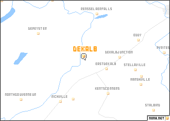
De Kalb (New York, United States - USA)De Kalb is a town in the New York region of United States - USA. An overview map of the region around De Kalb is displayed below.
regional and 3d topo map of De Kalb, United States - USA ::
De Kalb airports ::
The nearest airport is GTB - Fort Drum Wheeler Sack Aaf, located 57.7 km south west of De Kalb.
Other airports nearby include MSS - Massena Intl Richards Fld (62.5 km north east), ART - Watertown Intl (78.2 km south west), YOW - Ottawa Macdonald Cartier Intl (95.1 km north), YGK - Kingston (104.5 km west), Nearby towns ::
Coopers Falls (2.1km north) //
East De Kalb (3.8km south east) //
De Kalb Junction (5.5km east) //
Kents Corners (8.2km south east) //
Bigelow (8.8km south) //
[all distances 'as the bird flies' and approximate] 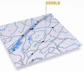 Places with similar names to De Kalb, United States - USA ::
Disclaimer :: Information on this page comes without warranty of any kind |
||
|
Where is De Kalb? Elevation and coordinates ::
Latitude (lat): 44°29'56"N Longitude (lon): 75°20'35"W
Elevation (approx.): 105m (map arrows pan, magnifying glasses zoom) |
||
|
Visiting De Kalb? Hotel/Accommodation ::
Book a hotel in De Kalb Travel Guide ::
rental cars ::
car rental offers GPS waypoint ::
download a GPX waypoint (PoI) of De Kalb for your GPS receiver
|
||